The Pacific Northwest, from the Olympic Peninsula to the Cascade volcanoes
Rainforests, a coast of headlands and lighthouses, redwoods and two active volcanoes. A two-week loop from Seattle, by way of the Olympic Peninsula, the Oregon coast and Mount Rainier.
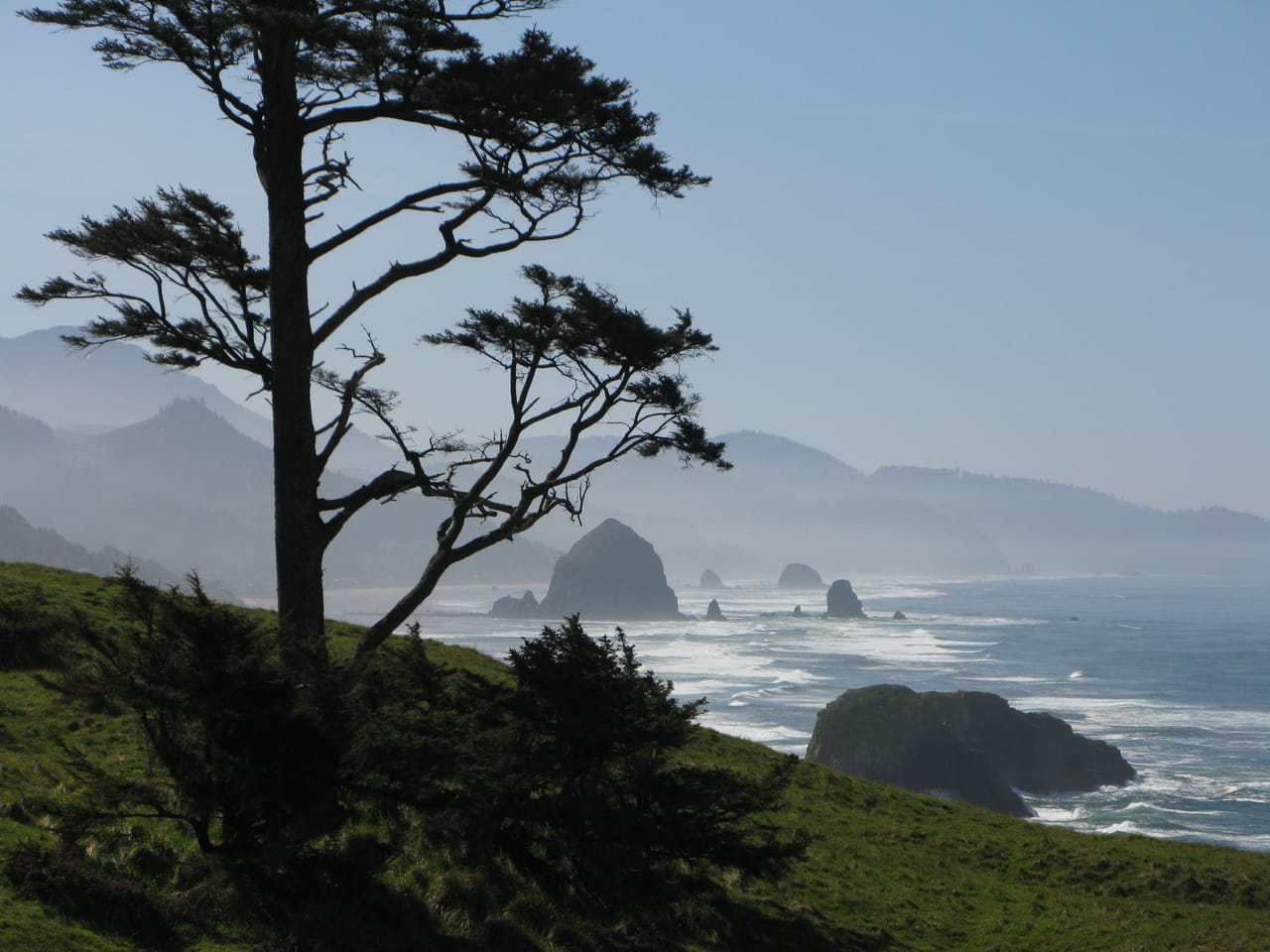
Forests, coast and volcanoes
The loop leaves Seattle for the Olympic Peninsula. From Port Angeles, a 27-kilometre road climbs to Hurricane Ridge, at almost 1,600 metres, facing Mount Olympus. US-101 then runs along Lake Crescent and reaches the Hoh Rain Forest, one of the wettest places in the contiguous United States. On the coast, Rialto Beach and Ruby Beach are covered in driftwood.
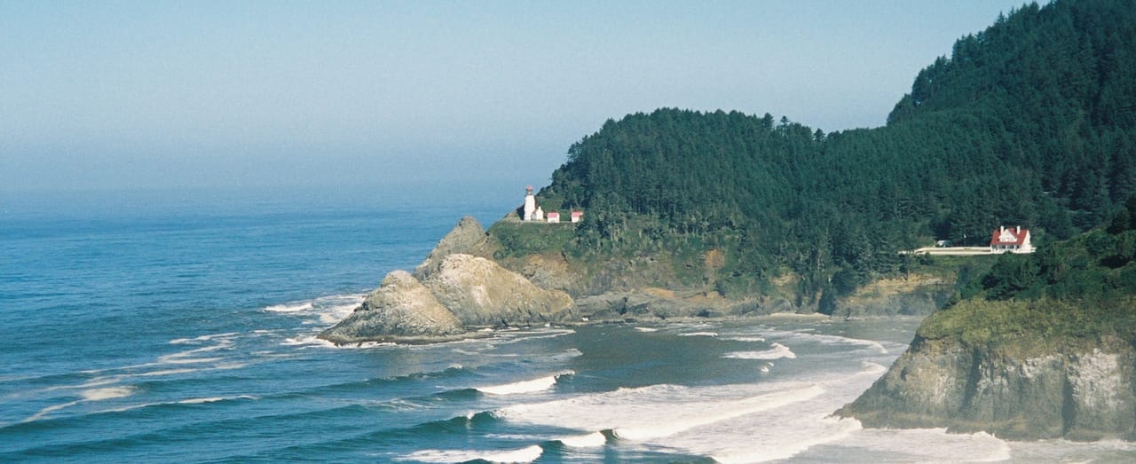
Further south, you follow the Oregon coast from headland to headland. All its beaches are open to the public, a right guaranteed by a 1967 law. You stop at Haystack Rock, at the foot of Cape Kiwanda or below the Heceta Head lighthouse. Between Florence and North Bend, the dunes stretch for 64 kilometres. The road then crosses into California, through the redwoods of Jedediah Smith.
Inland, Crater Lake fills the collapsed crater of an ancient volcano. At 594 metres, it is the deepest lake in the United States. At the foot of Mount Rainier, the Paradise meadows bloom in high summer.
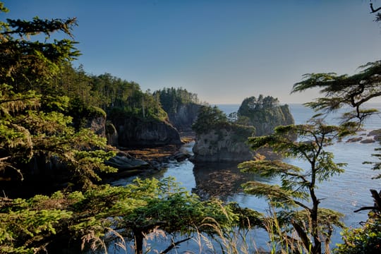
Cape Flattery and the Makah lands
Cape Flattery is the north-western tip of the contiguous United States. James Cook named it in 1778. The cape lies within the Makah Reservation. A trail of about 1.2 kilometres goes down through the forest to platforms above the cliffs. Below, the water is turquoise; out at sea, you can see Tatoosh Island and its lighthouse. To park, you need a Makah pass, sold in Neah Bay.
Under the Treaty of Neah Bay, in 1855, the Makah gave up most of their land but kept the right to hunt whales. It is the only US treaty that names this right in so many words. They took up the hunt again in 1999.
South of the cape, in 1970, a storm uncovered the village of Ozette, buried by a mudslide several centuries ago. The mud had preserved the wood. The excavations brought up more than 55,000 objects, from baskets to whaling tools. Some of them are on show at the Makah Museum in Neah Bay.
The mud had preserved the wood.
Mount St Helens, 18 May 1980
On 18 May 1980, at 8.32 am, a magnitude 5.1 earthquake brought down the north face of Mount St Helens. This collapse is the largest landslide ever recorded. A sideways blast flattened the forests over about 600 km². The eruption killed 57 people, among them the volcanologist David Johnston. The summit lost about 400 metres.
Coldwater Lake was born that day, when the debris dammed a creek. SR-504 climbs to it up the Toutle valley, and from the lake you see the crater, open to the north. Beyond it, the road has been cut since the 2023 landslide: the Johnston Ridge Observatory is not expected to reopen before 2027.
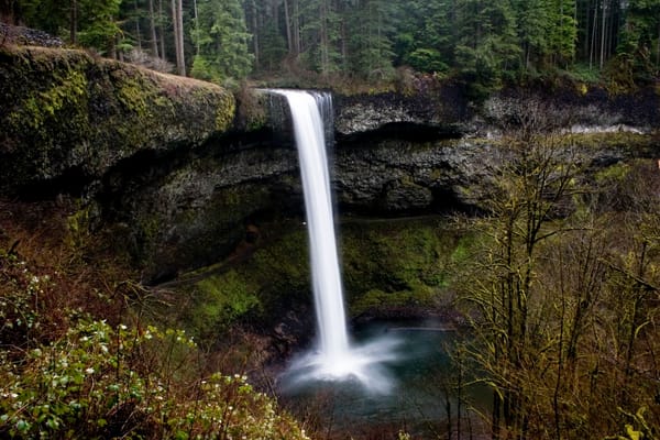
Silver Falls State Park
The largest state park in Oregon. The Trail of Ten Falls, an 11.6-kilometre loop, passes ten waterfalls and goes behind several of them, including South Falls, 54 metres high. Quieter than the Columbia River Gorge.
Practical notes
- When to go
- July to September, when the mountain roads are open and the meadows of Rainier are in flower. The Sunrise road only opens in summer.
- Getting there
- Seattle-Tacoma Airport is about twenty kilometres from the centre. The loop covers about 3,000 kilometres.
- Access
- Everything is tarmac. At Rainier, you must carry chains from 1 November to 1 May, and the Stevens Canyon tunnel has a height limit of 3.81 metres.
- Sleeping in a van
- Campsites in the national parks and in Oregon’s state parks, to be booked early for the summer.
- Worth knowing
- At the entrance to the Hoh Rain Forest, the wait can reach two hours in summer: arrive before 8 am or after 5 pm. At Multnomah Falls, a timed permit is required from late May to early September for the I-84 car park.
- Allow
- 15 days for the loop, one more day for Silver Falls.
What not to miss
- 1The Hoh Rain ForestThe Hall of Mosses, a short loop under moss-covered maples.
- 2Ecola State ParkThe view of Cannon Beach and Haystack Rock, a 72-metre basalt stack.
- 3AstoriaFounded in 1811, the first permanent American settlement west of the Rockies.
- 4Heceta HeadThe most powerful lighthouse on the Oregon coast, first lit in 1894.
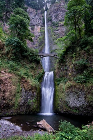
- 5The Columbia River GorgeVista House at Crown Point, and Multnomah Falls, the highest waterfall in Oregon (189 metres).
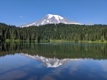
- 6Paradise and Reflection LakesThe flower meadows at the foot of Rainier, 4,392 metres high, and its reflection in the lakes.
The Pacific Northwest in pictures
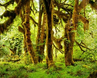
Moss-covered maples in the Hoh Rain Forest.
Food in the Pacific Northwest
Dungeness crab takes its name from a village on the Olympic Peninsula. Wild salmon is grilled on a cedar plank, the way the coastal peoples cook it. In Astoria and Newport, you eat clam chowder, a clam soup.
The Tillamook cooperative, founded in 1909, makes cheddar and ice cream; you can visit its creamery beside US-101. The Willamette Valley produces Pinot Noir, Portland craft beer. In Seattle, the first Starbucks opened in 1971, near Pike Place Market.
Loop from Seattle


 +39stops
- 1Space Needle · Ediz Hook
- 2Marymere Falls · Makah Museum · Cape Flattery
- 3Rialto Beach · Hoh Rainforest
Free, no account needed — start from its places and make it yours.
Also worth reading
Wide open spaces
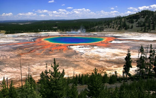
Yellowstone, Grand Teton and Glacier: the great Rockies road trip
Three national parks on one road, from the Tetons to the glaciers of Montana, by way of the geysers of Yellowstone. Twelve days from Jackson to Kalispell, with bison by the roadside and two great mountain roads.
Wide open spaces
California’s national parks, from Joshua Tree to Yosemite
Five national parks, from the lowest point in North America to the giant sequoias. A two-week loop from Los Angeles, through the Mojave Desert, Death Valley, the Sierra Nevada and Yosemite.
Wide open spaces
Highway 1, from San Francisco to Los Angeles via Big Sur
Highway 1 follows the Pacific from San Francisco to Los Angeles, past cliffs, surf beaches and towns that grew from the Spanish missions. Eight days on the road, with Big Sur in the middle.
A starting point, a few wishes — ViaLooma builds the trip day by day, map, stops and roadbook included.