New Zealand’s South Island by van, from Kaikōura to Milford Sound
Whales, three passes over the Southern Alps, glaciers, fiords and penguins. A seventeen-day loop from Christchurch, around the South Island.
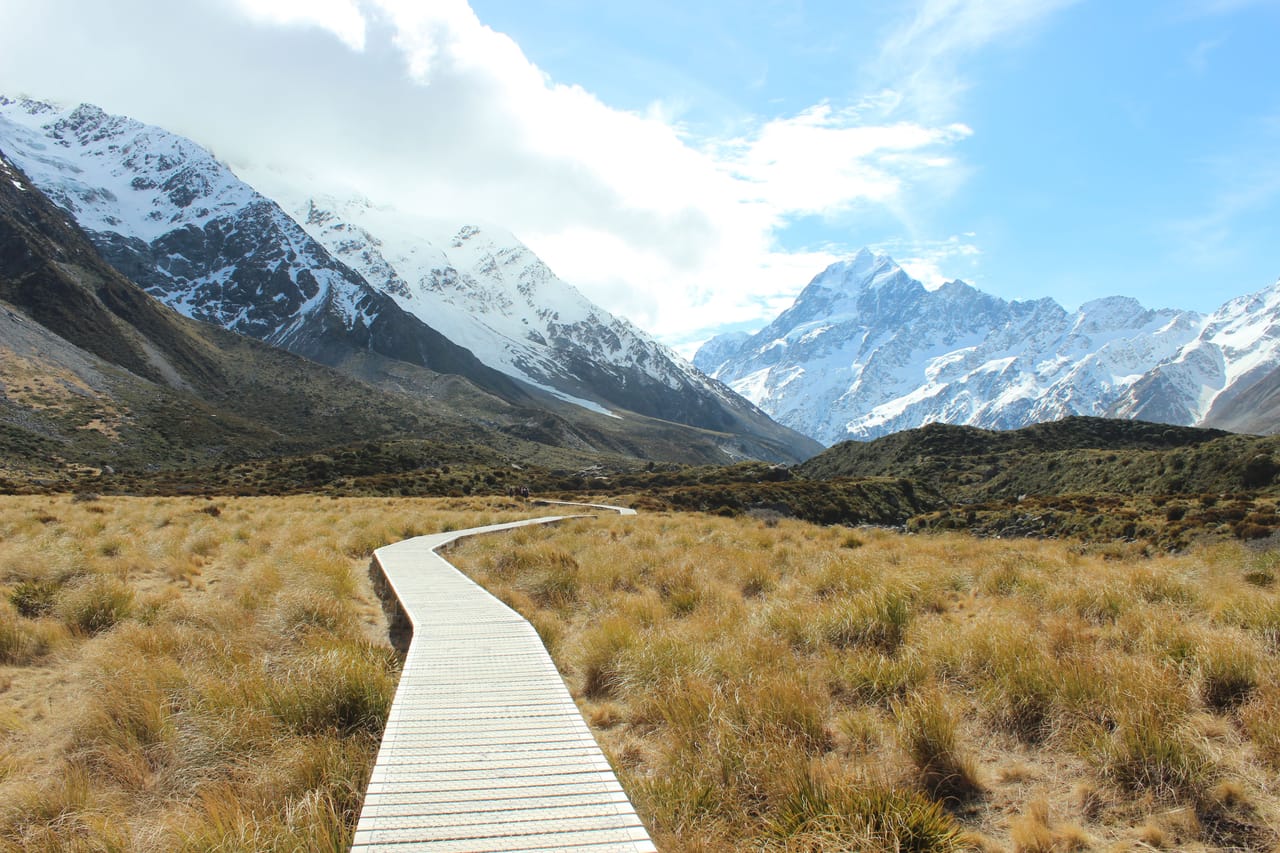
The great South Island loop
On the South Island, the road is often empty. You drive on the left, cross one-lane bridges and stop in the evening by a lake. In a single day, you leave the Tasman Sea and its rainforest for the Franz Josef and Fox glaciers. The seventeen-day loop starts in Christchurch and goes round the island.
Wildlife is a good part of the trip. At Kaikōura, boats go out to see sperm whales. At Arthur’s Pass, kea, mountain parrots, circle around the cars. In the Catlins and on the Otago Peninsula, you look out for penguins and albatrosses.
The Southern Alps are crossed by passes, such as Lewis Pass and its beech forests. Wānaka, Queenstown and their lakes lie among dry, golden hills. The Milford Road leads to Milford Sound, and the Lake Pukaki road to the foot of Aoraki / Mount Cook.
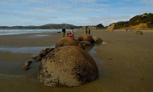
The island’s geology
On Koekohe Beach, north of Dunedin, the Moeraki Boulders are almost perfectly round rocks, the largest two metres across. They are concretions, formed in sea-floor mud some sixty million years ago. As the cliff wears away, it slowly releases them onto the sand. They are best seen at low tide.
The island is crossed by the Alpine Fault, the boundary between the Pacific and Australian plates. They slide past each other by nearly four centimetres a year, and their pressure pushes up the Southern Alps. Aoraki / Mount Cook, their highest peak, is 3,724 metres high.
At Punakaiki, the Pancake Rocks are layers of limestone, hard and soft, hollowed out by erosion: they look like stacks of pancakes. At high tide, the swell shoots up through blowholes. In the Catlins, at Curio Bay, the stumps of a petrified forest about 180 million years old appear at low tide.
The canoe became the island, the brothers the Southern Alps.
Māori names and legends
In Māori, the South Island is called Te Waipounamu, often translated as “the waters of pounamu”, the green stone still carved in Hokitika. Since a 1998 law in favour of the Ngāi Tahu, many places officially have two names, one Māori, the other English: Aoraki / Mount Cook, Haast Pass / Tioripatea.
According to tradition, Aoraki and his brothers were travelling by canoe when it ran aground on a reef; a cold wind turned them to stone. The canoe became the island, the brothers the Southern Alps. Franz Josef Glacier is called Kā Roimata o Hine Hukatere, “the tears of Hine Hukatere”, a young woman who wept for her lover. At Moeraki, so they say, the round boulders are the baskets of a wrecked canoe.
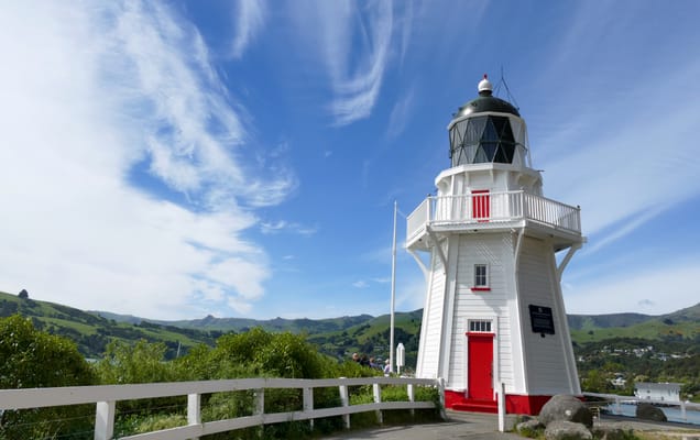
Akaroa
A village founded in 1840 by French settlers; some of its streets still have French names. It is built beside a long bay, inside an old volcano. Boats go out to see Hector’s dolphins, among the smallest in the world.
Practical notes
- When to go
- November to April, the warm season. From May to October, and sometimes into November, snow reaches the passes and the Milford Road.
- Getting there
- Pick up the van in Christchurch, which has an international airport. To enter the country: the NZeTA and the IVL tourist levy, online before you leave.
- Access
- Driving on the left. On the Milford Road: chains on board in winter, traffic lights at the Homer Tunnel, fill up in Te Anau. Little or no mobile signal in Fiordland and at Mount Cook.
- Sleeping in a van
- Since 7 June 2026, you need a green warrant and a fixed toilet to camp where a self-contained vehicle is required. Plenty of DOC campsites, such as Cascade Creek or White Horse Hill.
- Worth knowing
- Book the whale-watching trip, the Milford cruise, the albatrosses and the Oamaru penguins. The Fox Glacier road has been closed since 2019. Paid parking at Punakaiki, Franz Josef and Mount Cook since December 2025. An access fee for foreign visitors is being considered at Milford Sound and Aoraki, not before summer 2027–2028.
- Allow
- Seventeen days; three weeks with Abel Tasman and the Marlborough Sounds, in the north.
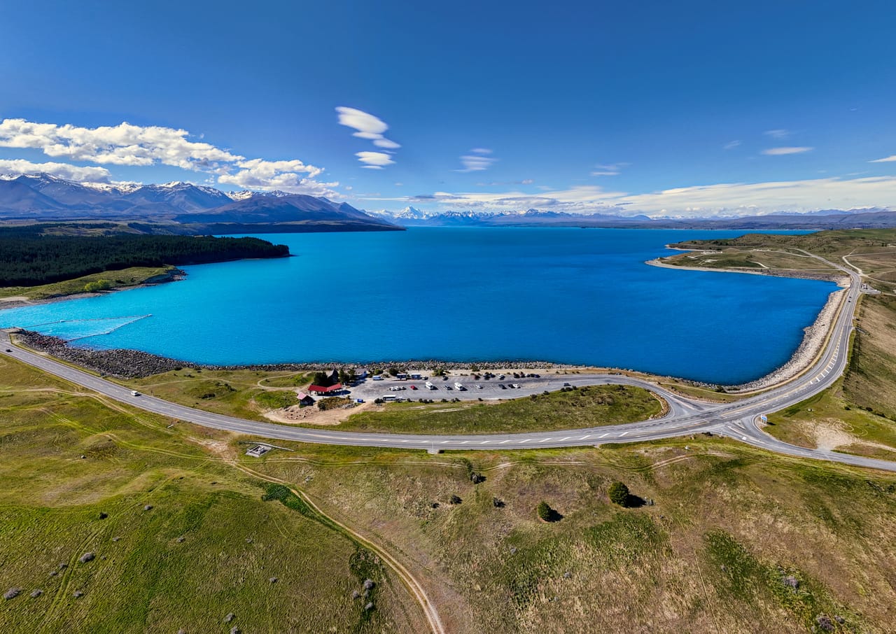
What not to miss
- 1Milford SoundThe fiord by boat out to the sea, beneath Mitre Peak, nearly 1,700 metres high.
- 2The sperm whales of KaikōuraAn undersea canyon brings them in close to the coast.
- 3The Hooker Valley TrackTen kilometres return to a glacial lake facing Aoraki, best done early in the morning.
- 4The albatrosses of Taiaroa HeadThe only albatross colony in the Southern Hemisphere on the mainland.
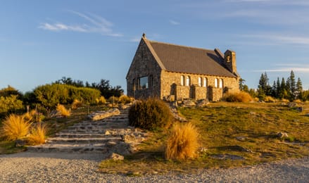
- 5Lake TekapoThe Church of the Good Shepherd by the water, and a starry sky protected since 2012.
- 6The Kawarau BridgeThe world’s first commercial bungy jumping site, 43 metres above the river.
The South Island in pictures
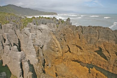
The layers of limestone of the Pancake Rocks, above the Tasman Sea.
The food of the South Island
Kaikōura means roughly “crayfish meal”, and crayfish is eaten along this coast. On the West Coast, in spring, people catch whitebait, tiny fish served as fritters. Around Twizel, salmon is farmed in the hydro canals.
The lamb comes from Canterbury and Otago. Central Otago makes pinot noir, around Gibbston and Bannockburn. In Dunedin, people drink Speight’s, a beer brewed in the city since the 19th century.
Loop from Christchurch


 +52stops
- 1Christchurch Botanic Gardens · Fyffe House · Point Kean Viewpoint
- 2Kaikoura Lookout · Waiau River Lookout · Hanmer Springs Thermal Pools & Spa
- 3Lewis Pass · School of Mines · Pancake Rocks
Free, no account needed — start from its places and make it yours.
Also worth reading
Wide open spaces
New Zealand’s North Island, from the Bay of Islands to Tongariro
From the beaches of the Bay of Islands to the volcanoes of Tongariro, the North Island brings together kauri forests, hot springs and Māori history. An eleven-day loop from Auckland, through the Coromandel, Rotorua and Taupō.
Wide open spaces
New Zealand in three weeks, from Auckland to Queenstown
From the beaches of the Coromandel to the fiords of Fiordland, by way of the geysers of Rotorua and the glaciers of the West Coast. Three weeks on the road from Auckland to Queenstown, across both islands.
Wide open spaces
The Pacific Northwest, from the Olympic Peninsula to the Cascade volcanoes
Rainforests, a coast of headlands and lighthouses, redwoods and two active volcanoes. A two-week loop from Seattle, by way of the Olympic Peninsula, the Oregon coast and Mount Rainier.
A starting point, a few wishes — ViaLooma builds the trip day by day, map, stops and roadbook included.