The Wicklow Mountains, from Powerscourt to Glendalough
South of Dublin, the Wicklow Mountains bring together great estates, peat moorland and valleys carved by glaciers. Three days on a loop from Dublin, by the Military Road, Lough Tay and St Kevin’s valley.
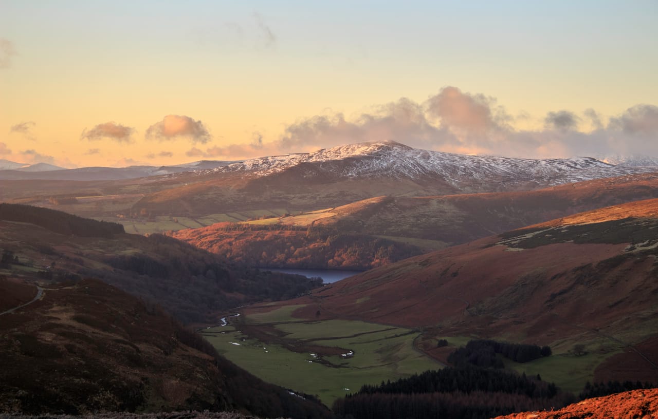
A loop through the mountains south of Dublin
The Wicklow Mountains begin less than an hour from Dublin. The loop goes from the gardens of great estates to a moorland of peat and heather, almost without trees, then drops back down into wooded valleys. The finest road is the Military Road (R115), built from 1800 to 1809 to hunt down the rebels of 1798 hiding in the mountains. Near the Kippure transmitter, it climbs to 523 metres: this is the highest paved public road in Ireland.
It comes back down to the crossroads at Sally Gap, at around 500 metres. A little to the east, the R759 looks down on Lough Tay, a dark lake with a pale beach at the foot of the Luggala cliffs. It is called the “Guinness Lake”: the estate belonged to the Guinness family, who are said to have brought in the sand to look like a pint of stout. Further south, the Military Road runs past Glenmacnass Waterfall and down towards Glendalough.
To the south, the Vale of Avoca leads to the village of Avoca, where the series Ballykissangel was filmed. West of Laragh, the R756 climbs to the Wicklow Gap, at 475 metres.
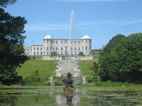
Powerscourt and the great houses
Just outside Enniskerry, Powerscourt was the estate of the viscounts of the same name. The architect Richard Castle rebuilt the house from 1731 to 1741, in the Palladian style. The gardens, finished in 1880 after twenty years of work, step down in terraces to Triton Lake and its fountain. There is also a Japanese garden. On 4 November 1974, a fire destroyed the house. It has been restored, but only two rooms can be visited, furnished as they once were.
Richard Castle also designed Russborough House, built from 1741 to 1755. In 1952, Sir Alfred Beit bought it to show his collection of paintings. The house has been robbed four times, including by the IRA in 1974 and by the gangster Martin Cahill in 1986. The collection’s Vermeer was stolen twice, its Gainsborough three times. Two views of Venice by Guardi have never been found.
Near Rathdrum, Avondale House is the birthplace of Charles Stewart Parnell, born in 1846, leader of the movement for Irish Home Rule. Since 2022, a walkway through the treetops has crossed the forest there.
The collection’s Vermeer was stolen twice, its Gainsborough three times.
Glendalough, St Kevin’s valley
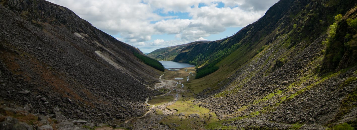
Glendalough comes from the Irish Gleann Dá Loch, “the valley of the two lakes”. In the 6th century, the hermit St Kevin founded a monastery here, which grew into a real city. What remains is a round tower about 30 metres high and a stone church, Kevin’s Kitchen: its bell tower looks like a chimney, but no one ever cooked there. The English destroyed the site in 1398, but it remains a place of pilgrimage.
The two lakes lie in a valley carved by glaciers in the granite and schist. From the visitor centre, you can walk to the Upper Lake in twenty minutes. Keen walkers do the Spinc loop, about 9 km above the lake, by way of the old miners’ village. Above the water, a cave in the cliff, St Kevin’s Bed, was the saint’s refuge, according to tradition.
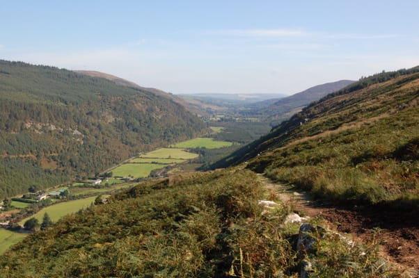
Glenmalure
One of the longest glacial valleys in Ireland, far quieter than Glendalough. In 1580, Fiach MacHugh O’Byrne routed an English army here. The road ends at the Baravore car park, from where you climb Lugnaquilla, 925 metres, the highest summit in Leinster.
Practical notes
- When to go
- May to September; the heather flowers in August. In winter, the roads around Sally Gap are not gritted and snow can close them.
- Getting there
- Start from Dublin. The toll on the M50 ring road is paid online by 8 pm the following day, unless the hire company does it for you.
- Access
- Everything is tarmac. The Military Road and the R759 are narrow, with sheep on the road: passing is tight in a large van.
- Sleeping in a van
- Campsites at Roundwood (in summer), at Redcross and near Rathdrum. In the national park, only wild camping by hikers is allowed.
- Worth knowing
- On sunny days, the car parks at Glendalough and Lough Tay are full, and parking on the verges can get you a fine or towed away.
- Allow
- Three days for the loop, one more to walk at Glenmalure.
What not to miss
- 1Powerscourt WaterfallA 121-metre fall, one of the highest in Ireland, with a separate ticket.
- 2The Lough Tay viewpointThe dark lake and its pale beach, seen from above on the Sally Gap road.
- 3GlencreeA German war cemetery, and a centre for peace in an old barracks on the Military Road.
- 4Glenmacnass WaterfallThe river drops from the plateau into its valley, beside the Military Road.
- 5The Wicklow GapA pass at 475 metres on St Kevin’s Way, the pilgrims’ path to Glendalough.
- 6AvocaA woollen mill founded in 1723, where you can still watch the wool being woven.
The Wicklow Mountains in pictures
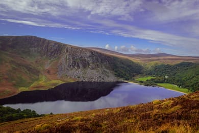
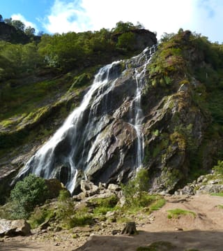
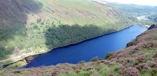
Lough Tay, its dark water and pale beach, below Luggala.
The Wicklow table
The mountain sheep give Wicklow lamb, served roast in Laragh or at the Glenmalure Lodge, a pub with a turf fire on the Wicklow Way.
Glendalough Distillery, founded in 2011, started with a poitín, the traditional Irish spirit, then gins made with seasonal wild plants. In Avoca, the mill café serves scones after the visit.
Loop from Dublin city


 +9stops
- 1Enniskerry · Powerscourt Estate · Powerscourt Waterfall · Glencree
- 2Sally Gap · Lough Tay · Glenmacnass Waterfall · Glendalough
- 3Avoca · Avondale House · Wicklow Gap · Russborough House
Free, no account needed — start from its places and make it yours.
Also worth reading
Wide open spaces
Yellowstone, Grand Teton and Glacier: the great Rockies road trip
Three national parks on one road, from the Tetons to the glaciers of Montana, by way of the geysers of Yellowstone. Twelve days from Jackson to Kalispell, with bison by the roadside and two great mountain roads.
Wide open spaces
California’s national parks, from Joshua Tree to Yosemite
Five national parks, from the lowest point in North America to the giant sequoias. A two-week loop from Los Angeles, through the Mojave Desert, Death Valley, the Sierra Nevada and Yosemite.
Wide open spaces
New Zealand’s South Island by van, from Kaikōura to Milford Sound
Whales, three passes over the Southern Alps, glaciers, fiords and penguins. A seventeen-day loop from Christchurch, around the South Island.
A starting point, a few wishes — ViaLooma builds the trip day by day, map, stops and roadbook included.