The Ring of Kerry and the Dingle Peninsula
Two peninsulas in south-west Ireland, between lakes, mountains and cliffs above the Atlantic. Six days on a loop from Killarney, from Slea Head to Ladies View.
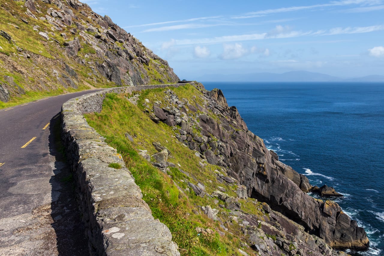
Two peninsulas facing the Atlantic
South-west Ireland reaches out into the Atlantic in long peninsulas. This trip covers two: Dingle, then the Iveragh, which the Ring of Kerry goes round in 179 kilometres. You start from Killarney, beside lakes surrounded by oak woods and mountains. You explore them by rowing boat or by jaunting car, the local horse-drawn carriage.
On Dingle, the Slea Head road skirts the tip of the peninsula, sometimes on a single lane, facing the Blasket Islands. You drive it clockwise, as the signs show. By car, you climb to the Conor Pass, at 456 metres, above glacial lakes.
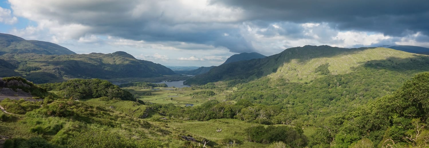
The Ring is driven in the same direction as the coaches, from Killorglin towards Cahersiveen: that way you rarely meet a coach head-on. A bridge leads to Valentia Island, then the Skellig Ring passes near the Kerry Cliffs, about 300 metres high, and crosses a pass facing the Skelligs. The way back runs through Kenmare, Moll’s Gap and Ladies View, above the lakes.
Stone forts and monasteries
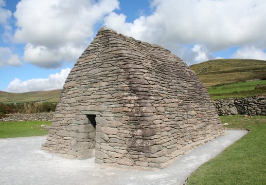
Near the Slea Head road, Gallarus Oratory is a small chapel shaped like an upturned boat. Its sloping walls meet at the top, with no roof timbers: each row of stones sits a little further in than the one below. Its date is still debated: between the 7th and the 12th century, depending on the author. Close by, the monastic site of Riasc keeps the remains of monks’ cells and a carved standing stone.
About a dozen kilometres off the coast, Skellig Michael, on the UNESCO World Heritage List since 1996, holds a monastery founded between the 6th and the 8th century. You climb 600 steps to stone cells shaped like beehives. The monks are thought to have left it around the 13th century for Ballinskelligs, where the ruined priory stands beside the beach.
The stone forts are often older than the monasteries. Staigue Fort, near Castlecove, is a round enclosure with dry-stone walls up to 5.5 metres high in places; it probably dates from the late Iron Age. On Dingle, Dunbeg is a promontory fort, part of which has already fallen into the sea.
The Great Blasket was evacuated in 1953.
The Irish language and the Blasket Islands
The west of the Dingle Peninsula is a Gaeltacht, an area where Irish is protected as the language of the community. Road signs there are in Irish: Dunquin becomes Dún Chaoin. In 2005, the English place names there lost all official status. The main town is the exception: after a local vote, it has had two official names since 2011, Dingle and Daingean Uí Chúis.
Opposite Dún Chaoin, the Great Blasket was home to fishing families. Several islanders, including Peig Sayers, told the story of their lives in Irish. Tomás Ó Criomhthain published An tOileánach, “The Islandman”, in 1929. The Great Blasket was evacuated in 1953. The Blasket Centre, in Dún Chaoin, tells their story.
Gap of Dunloe
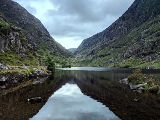
A glacial pass between the Macgillycuddy’s Reeks and the Purple Mountain range, with five small lakes. From Kate Kearney’s Cottage, the track runs for 11 kilometres, on foot, by bike or by jaunting car. The road is narrow: best leave the car at the entrance.
Practical notes
- When to go
- May to September, when the boats run to the islands. July and August fill the Ring. It rains often, in every season.
- Getting there
- Killarney has a railway station; Kerry Airport is about twenty minutes away. Cork is about an hour and a half by road.
- Access
- Drive on the left, narrow roads. The Conor Pass is closed to vehicles over 2 tonnes: motorhomes take the N86.
- Sleeping in a van
- Campsites around Killarney and in the villages of both peninsulas, many closed in winter. Many seafront car parks ban motorhomes overnight.
- Worth knowing
- Skellig Michael is visited by boat, mostly from Portmagee, from May to September, sea permitting, and only by booking ahead. The 2026 season closed on 21 September.
- Allow
- Six days for both peninsulas, one more day for Skellig Michael or the Gap of Dunloe.
What not to miss
- 1MuckrossAn 1843 mansion beside the lake and, a kilometre away, a Franciscan abbey with a yew tree in its cloister.
- 2Inch BeachA sandy beach five kilometres long, facing the mountains of the Iveragh.
- 3Dún Chaoin pierA zigzag path down the cliff to clear water, facing the Blaskets.
- 4ValentiaThe Fogher Cliffs, 180 metres high, reached by the Geokaun toll road.
- 5Derrynane HouseThe home of Daniel O’Connell, the man behind Catholic Emancipation in 1829.
- 6Moll’s Gap and Ladies ViewA pass facing the Macgillycuddy’s Reeks, then a viewpoint over the lakes, named, it is said, after Queen Victoria’s ladies-in-waiting.
The Ring of Kerry and the Dingle Peninsula in pictures
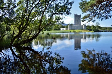
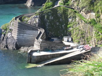
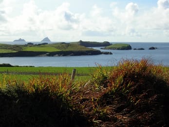
Ross Castle and its reflection in Lough Leane.
The Kerry table
Kerry lives off farming and the sea: mountain lamb, and salmon, crab and lobster landed at Dingle and Portmagee. Chowder, a thick fish soup, is served in almost every pub. Kenmare has a name as a small town for good food.
In Dingle, Murphy’s makes its ice cream with milk from Kerry cows, a local breed. The Dingle Distillery, opened in 2012, makes whiskey and gin. In August, Killorglin’s Puck Fair crowns a goat “King Puck” for three days.
Loop from Killarney


 +20stops
- 1Killarney · Ross Castle · Muckross House · Torc Waterfall
- 2Inch Beach · Caisleán na Mine Airde · Dingle/Daingean Uí Chúis
- 3Dunbeg Fort · Slea Head · Dún Chaoin pier · Gallarus Oratory
Free, no account needed — start from its places and make it yours.
Also worth reading
Wide open spaces
The northern Wild Atlantic Way, from Donegal to Mayo
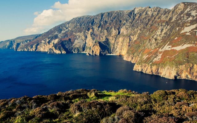
Some of the highest cliffs in Europe, moorland where people speak Irish and beaches at the end of the road. A week on the west coast of Ireland, from the tip of Inishowen to Westport.
Wide open spaces
Connemara and the Cliffs of Moher
Cliffs 214 metres above the Atlantic, a plateau of bare limestone, bogs and lakes at the foot of the mountains. A five-day loop from Galway, from the Burren to Connemara.
Wide open spaces
The Pacific Northwest, from the Olympic Peninsula to the Cascade volcanoes
Rainforests, a coast of headlands and lighthouses, redwoods and two active volcanoes. A two-week loop from Seattle, by way of the Olympic Peninsula, the Oregon coast and Mount Rainier.
A starting point, a few wishes — ViaLooma builds the trip day by day, map, stops and roadbook included.