Sweden’s High Coast, between Härnösand and Örnsköldsvik
On the Gulf of Bothnia, the High Coast is a line of wooded hills, deep bays and red fishing villages. A four-day loop from Härnösand, on a coast that is still rising out of the sea.
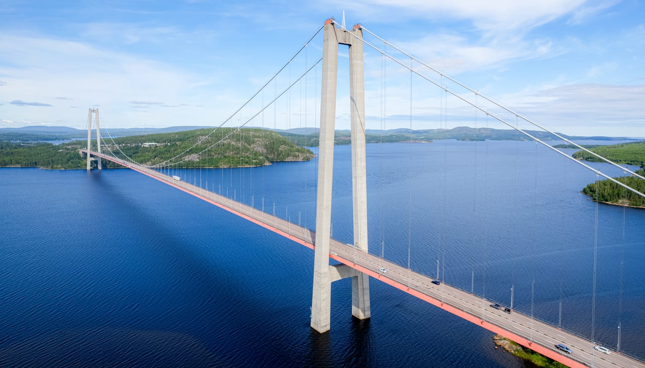
A coast of bays, forests and red villages
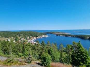
North of Härnösand, the E4 crosses the Ångermanälven on the High Coast Bridge (Högakustenbron), 1,867 metres long. On the other side, pine-covered hills run down to the sea, between deep bays and islands. This is the High Coast, Höga Kusten in Swedish. You soon leave the main road for the small roads of the Nordingrå peninsula, lined with farms painted red.
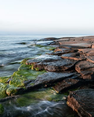
The fishing villages follow one another: Barsta, Bönhamn, Norrfällsviken, with their red huts by the water. In summer, a boat leaves from Barsta or Bönhamn for Högbonden, a small island with a lighthouse. At Rotsidan, smooth diabase slabs, polished by the sea, line the coast for 4 kilometres.
Further north, Skuleberget rises beside the E4. You can get to the top by chairlift, on foot or by a via ferrata. Right next to it begins Skuleskogen National Park. The loop goes up to Örnsköldsvik, at the foot of the Paradiskullen ski jumps, then heads back south to Härnösand.
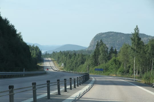
A land rising out of the sea
At Docksta, Skuleberget, 295 metres high, drops almost sheer to the E4. On its slopes are the traces of an old shoreline at 286 metres above sea level: it is the highest known shoreline in the world. During the last ice age, the region was pressed down under a layer of ice nearly 3 kilometres thick. Since the ice melted, about 9,600 years ago, the land has been rising. This is why the High Coast was added to the UNESCO World Heritage List in 2000.
The coast is still rising by about 8 millimetres a year. So you find old beaches high up in the forest, well above the sea. The easiest to see are the cobble fields: slopes covered with round stones, once rolled by the waves. There are several in Skuleskogen.
The park also has a curiosity: Slåttdalsskrevan, a crevice 200 metres long, 30 metres deep and 7 metres wide. A dyke of diabase, weaker than the granite around it, slowly eroded away here. Since June 2023, the passage at the bottom has been closed because of falling rocks. A path runs above the crevice.
The coast is still rising by about 8 millimetres a year.
Herring fishermen and timber workers
For centuries, fishermen from Gävle, further south, came north every summer for the Baltic herring. They built the harbours of red huts that you still see today. On the island of Ulvön, the wooden chapel at Ulvöhamn, from 1622, is one of the oldest fishermen’s chapels on the coast.
Inland, the Ådalen valley lived from timber and sawmills. On 14 May 1931, at Lunde, the army opened fire on workers who had come to protest against strikebreakers: five people died. The event shook the whole of Sweden. Not far away, Sandö Bridge, opened in 1943, held the record for the longest concrete arch in the world until 1964. During construction, in 1939, its formwork collapsed: 18 workers died.
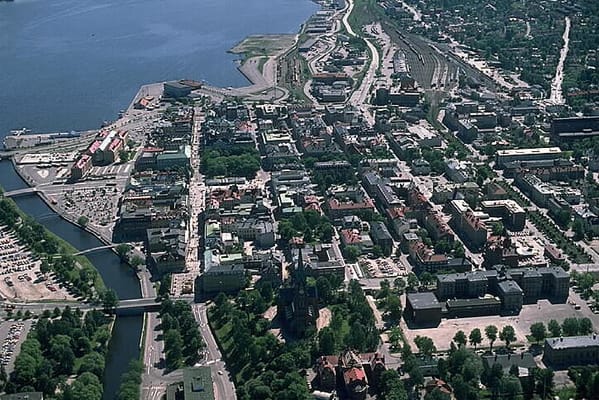
Stenstan
In June 1888, a fire destroyed the centre of Sundsvall. After that, the town allowed only stone. The timber merchants built apartment blocks with turrets there: this is Stenstan, the “stone town”.
Practical notes
- When to go
- From mid-June to mid-August, when the boats, museums and cafés are open. In September, many services close.
- Getting there
- Härnösand is about five hours from Stockholm on the E4. Sundsvall-Timrå Airport is 32 kilometres south of Härnösand.
- Access
- Tarmac roads, narrow on the Nordingrå peninsula, and a few gravel tracks. Dipped headlights are compulsory during the day.
- Sleeping in a van
- Campsites in the fishing villages and near the towns. In nature reserve car parks, the signs tell you whether you can stay the night.
- Worth knowing
- For Skuleskogen, the West entrance, signposted from the E4, is the easiest. The boat to Högbonden must be booked.
- Allow
- Four days for the loop, one more for the island of Ulvön.
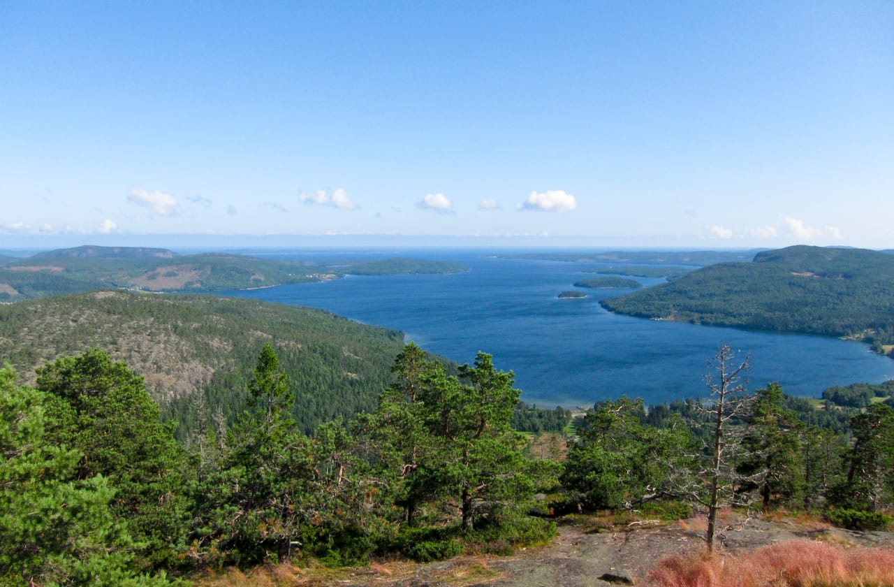
What not to miss
- 1The High Coast BridgeA 1,210-metre main span over the Ångermanälven.
- 2RotsidanSmooth diabase slabs by the sea, to walk across barefoot.
- 3HögbondenA lighthouse island a quarter of an hour away by boat, with a café in summer.
- 4The top of SkulebergetThe view over the archipelago, after the chairlift or the via ferrata.
- 5SlåttdalsskrevanA crevice in the red granite, in the heart of Skuleskogen, seen from above.
- 6MannaminneAnders Åberg’s open-air museum in Nordingrå: more than 50 buildings, from here and elsewhere.
The High Coast in pictures
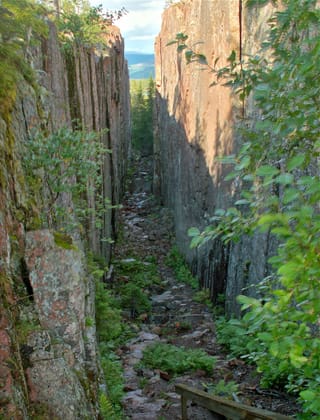
Slåttdalsskrevan, the corridor between two walls of red granite. The passage at the bottom has been closed since June 2023; today you see it from above.
Food on the High Coast
Above all, people eat strömming, Baltic herring: fried, pickled or smoked. The best-known dish is surströmming from Ulvön, a fermented herring with a very strong smell. You open the tin outdoors, then eat the fish with tunnbröd, a flatbread, potatoes and onion.
For dessert, cloudberries, an orange berry from the North, are served as jam on ice cream or a waffle. And everywhere, coffee comes with a kanelbulle, the cinnamon bun.
Loop from Härnösand


 +11stops
- 1Härnösands domkyrka · Högakustenbron · Mannaminne · Nordingrå
- 2Rotsidan · Barsta · Norrfällsviken · Ullångers kyrka
- 3Skuleberget · Slåttdalsskrevan · Paradiskullen
Free, no account needed — start from its places and make it yours.
Also worth reading
Wide open spaces
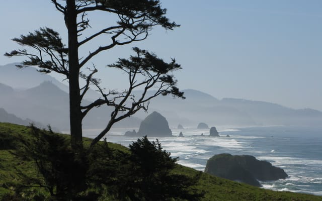
The Pacific Northwest, from the Olympic Peninsula to the Cascade volcanoes
Rainforests, a coast of headlands and lighthouses, redwoods and two active volcanoes. A two-week loop from Seattle, by way of the Olympic Peninsula, the Oregon coast and Mount Rainier.
Wide open spaces
Vancouver Island, from Victoria to the beaches of Tofino
An island of giant forests, beaches pounded by the Pacific and small harbours where boats leave to see orcas. Nine days on a loop from Victoria, from Port Renfrew to Tofino and up to Telegraph Cove.
Wide open spaces
Yellowstone, Grand Teton and Glacier: the great Rockies road trip
Three national parks on one road, from the Tetons to the glaciers of Montana, by way of the geysers of Yellowstone. Twelve days from Jackson to Kalispell, with bison by the roadside and two great mountain roads.
A starting point, a few wishes — ViaLooma builds the trip day by day, map, stops and roadbook included.