Roadbook · by ViaLooma
Loop from Faro
Featured in The Algarve, from golden cliffs to the Costa Vicentina
The route — Faro · loop
Day 1 Faro → Tavira 4 stops · 42 km · ≈ 54 min
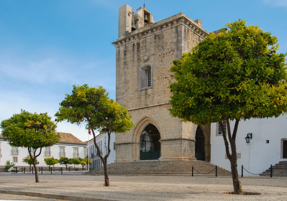
01 Church
Faro Cathedral
Sé de Faro
Faro · 1 km · 4 min
AI contentBegun in 1251, the Sé de Faro succeeded that of Silves in 1577 as the seat of the Algarve diocese. In 1596, the English soldiers of the Earl of Essex looted and then burnt it, and few medieval stones survived. Look for them in the façade tower, the main portal and the Gothic chapels of the transept.
02 Church
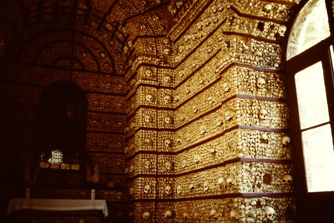
Capela dos Ossos
Faro · 2 km · 7 min
AI contentBehind the Carmo church in Faro, a small room 4 metres by 6 is built entirely from the bones of more than 1,000 Carmelites. Read the inscription above the entrance, which asks passers-by to stop and reflect that they will end up the same way. The chapel, inaugurated in 1816, has 1,245 skulls lined up along its walls.
03 Market
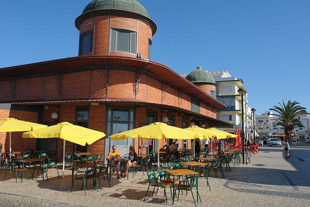
Mercado
Olhão · 11 km · 16 min
04 Castle
Castle of Tavira
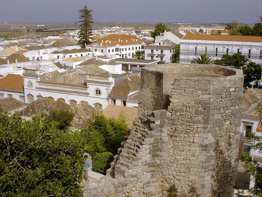
Castelo de Tavira
Tavira · 28 km · 27 min
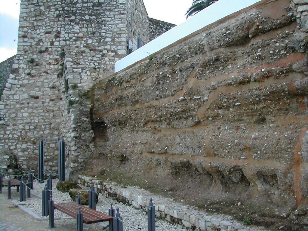
AI contentAbove the mouth of the Gilão, these walls keep the memory of at-Tabira, a Muslim stronghold besieged by the Almohads before the Christian reconquest. Walk on ground where excavations in 1997 revealed a Phoenician wall from the 8th century BC. Below, the town's rooftops tumble down towards the river.
The night — Booking, Park4night or Airbnb
Day 2 Vila Real de Santo António → Lagoa 4 stops · 124 km · ≈ 2h16
05 Nature park
Cacela Velha
Vila Real de Santo António · 13 km · 16 min
AI contentPerched on a fossil cliff, Cacela Velha overlooks the Ria Formosa and the barrier island where the beach stretches out. Between its 17th-century fortress and its church of medieval origin, the white village was the birthplace of the poet Ibn Darraj al-Qastalli. Wait for low tide to see the sandbanks trace their pale curves below the ramparts.
06 Archaeology
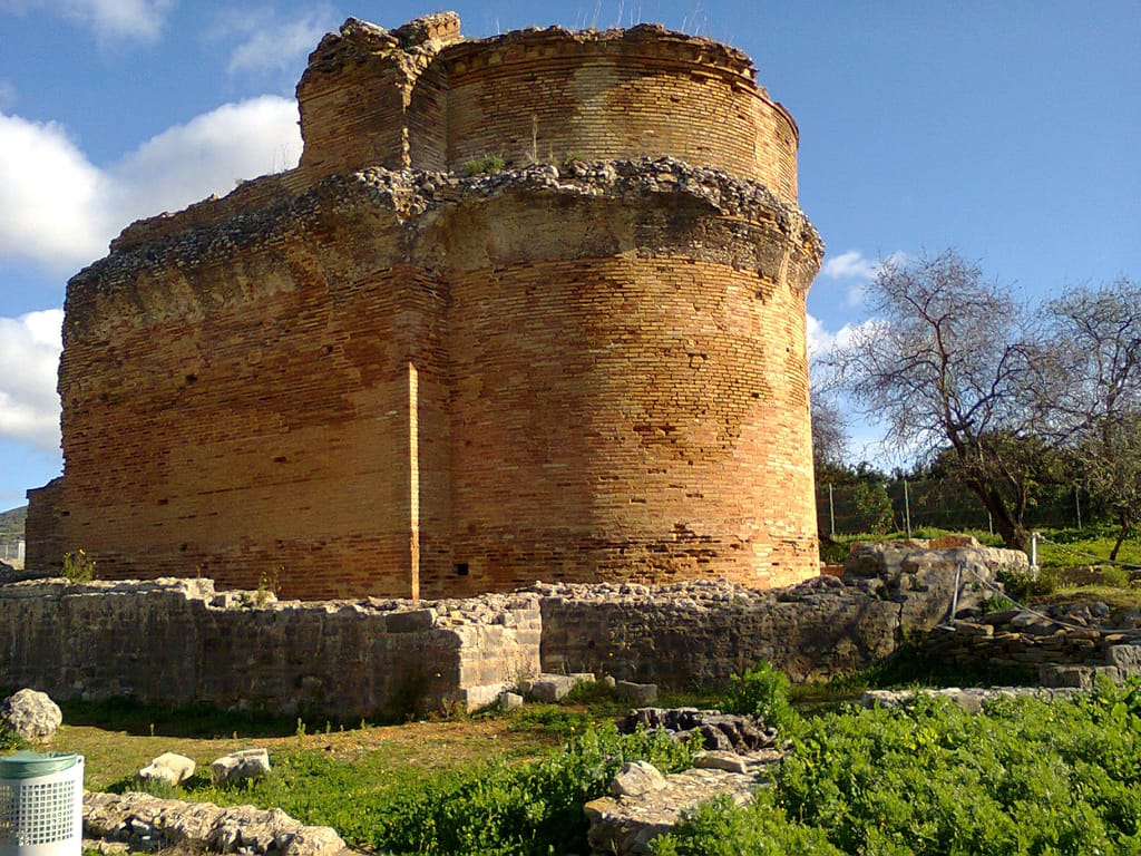
Roman ruins of Milreu
Ruínas de Estoi
Faro · 42 km · 35 min
AI contentAt Milreu, step into the private world of a wealthy Roman estate, inhabited from the 1st century and equipped with baths. The temple raised in the 4th century later served Christian and then Muslim worship, and a 16th-century house settled on top of the ruins. Its mosaic panels made its name in the Barrocal, the inland Algarve.
07 Beach · Family
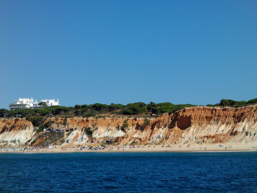
Falésia Beach
Praia da Falésia
Albufeira · 34 km · 38 min
AI contentWalk at the foot of the cliffs of the Praia da Falésia, red here and whitish further on, up to forty metres high. Rain carves deep gullies into the soft clay, and this erosion feeds the vast 5.5-kilometre beach. At the top, umbrella pines shelter paths that follow the coast.
08 Beach · Family
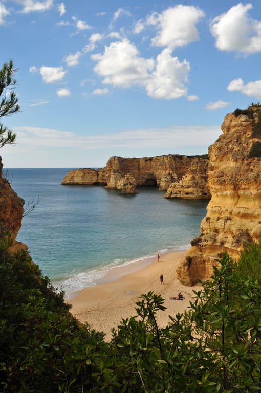
Praia da Marinha
Lagoa · 35 km · 47 min
AI contentHead down to Praia da Marinha, tucked beneath the Caramujeira cliffs, between Carvoeiro and Lagoa. The water is so clear that the seabed shows through from the surface, at the foot of ochre limestone arches and stacks. Above, the clifftop path reveals the cove from another angle.
The night — Booking, Park4night or Airbnb
Day 3 Lagoa → Lagos 4 stops · 55 km · ≈ 1h06
09 Beach · Family
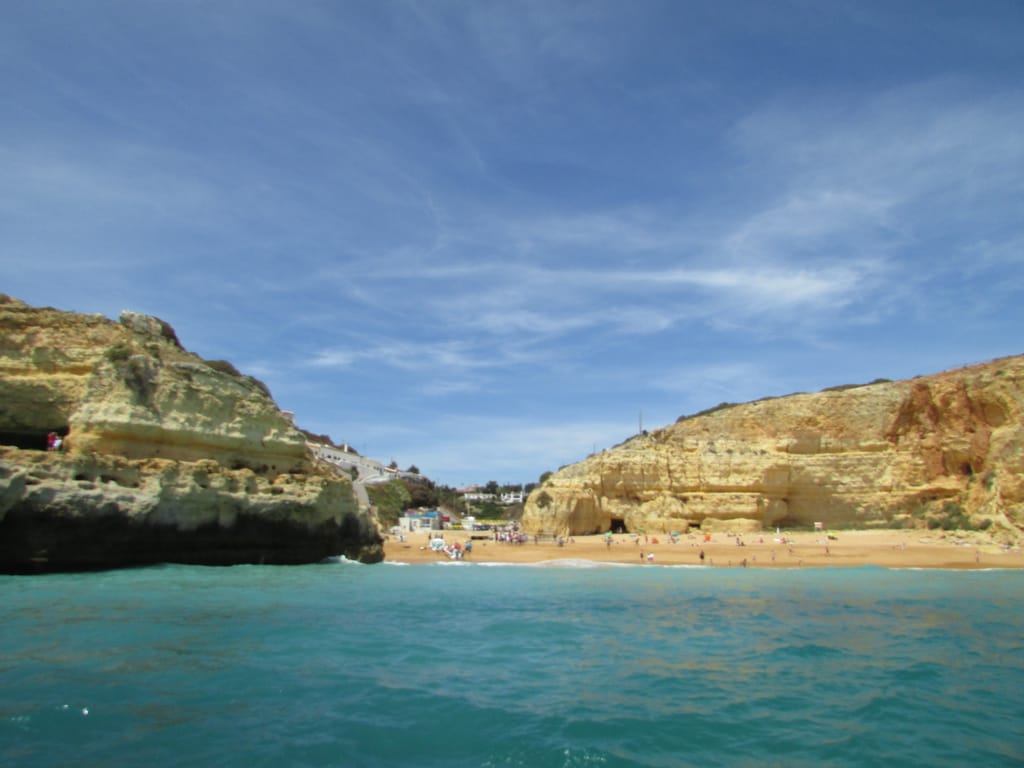
Benagil
Praia de Benagil
Lagoa · 3 km · 4 min
AI contentSit on the sand at Benagil, a former fishing village, and follow the boats skirting the cliff. They head for the Algar de Benagil, a sea cave pierced both through its side and its roof, where the sun falls on a hidden beach. These days, only supervised trips go in, for two minutes at most, without landing.

10 Nature
Algar Seco
Lagoa · 5 km · 8 min
AI contentNext to Carvoeiro, a former fishing village, the limestone is hollowed into cavities and caves open to the ocean. Wind and swell have shaped this maze over the millennia, and light pours in through every gap. Listen to the surf rumbling beneath the rocks, then let your gaze drift out to sea.

11 Village
Ferragudo
Lagoa · 9 km · 15 min
AI contentAt the mouth of the Arade, Ferragudo keeps the look of a fishing village facing Portimão on the opposite bank. On the former town hall, notice a bishop's mitre crowning the arms of Portugal, a reminder of the Bishop of Silves, who mattered greatly to the town. Further south, the castle of São João do Arade watches over the river mouth.
12 Coast
Ponta da Piedade
Lagos · 38 km · 39 min
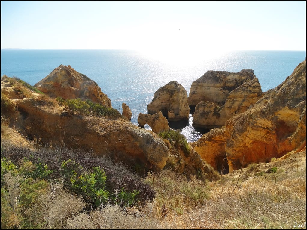
AI contentNear Lagos, the sea has carved Ponta da Piedade into arches, pillars and caves of golden rock. Go down from the lighthouse by the steps cut into the cliff to get close to the water at the foot of the rocks. One of the caves bears the name of the poet Sophia de Mello Breyner Andresen, who often came to explore them.
The night — Booking, Park4night or Airbnb
Day 4 Lagos → Vila do Bispo 4 stops · 51 km · ≈ 1h19

13 Heritage
Mercado de Escravos
Lagos · 4 km · 10 min
AI contentWalk past these sober arcades, probably the site of the first sale of African slaves in Europe, in the 15th century. In 1444, some 240 captives brought from Arguin were divided up in Lagos, and Gomes Eanes de Zurara described the families torn apart. The upper floor, added in 1691 for a guardhouse, bears the coat of arms of the Marquis of Nisa.
14 Beach · Family
Salema, Portugal
Praia da Salema
Vila do Bispo · 19 km · 31 min
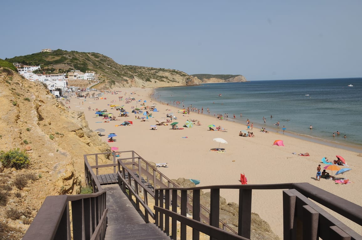
AI contentOn Salema beach, the boats and their pots still occupy the middle of the sand, below the village's white façades. Watch the boats return from fishing and, from a platform near a staircase, look for dinosaur footprints imprinted in the rock. These tracks, marked by a sign, were only officially recognised in 2001.
15 Castle
Fortress of Sagres
Fortaleza de Sagres
Vila do Bispo · 21 km · 28 min
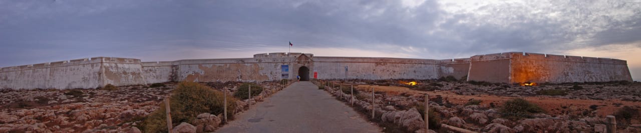
AI contentOn Cabo de Sagres, a wall closes the only access to a steep headland above the Atlantic, a place linked to Prince Henry and the Discoveries. On the site, find a compass rose laid out in stones, whose 32 rays keep a meaning never established. A walkway about two kilometres long then runs along the cape.
16 Coast
Cape St. Vincent
Cabo de São Vicente
Vila do Bispo · 7 km · 10 min
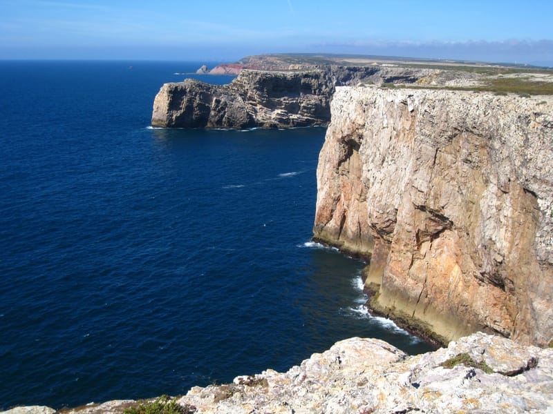
AI contentOn this headland that closes off Iberia to the south-west, the Romans saw a sacred place, the Promontorium Sacrum. Strabo placed the western end of the inhabited world here; a lighthouse now stands near a 16th-century fortress. Listen to the wind and the swell pounding the cliff, facing the Atlantic.
The night — Booking, Park4night or Airbnb
Day 5 Aljezur → Odeceixe 4 stops · 77 km · ≈ 1h46

17 Village
Carrapateira, Aljezur
Carrapateira
Aljezur · 29 km · 32 min
AI contentLook up at the hill where, in 1673, the Count of Pontével enclosed the church of Carrapateira within a fort against pirates. Facing the ocean, the reddish cliffs of the Pontal looked so much like Cape St Vincent that they led sailors astray. To the north stretch the Bordeira dunes, to the south the rollers of Amado.
18 Beach · Family
Praia da Arrifana
Aljezur · 23 km · 34 min
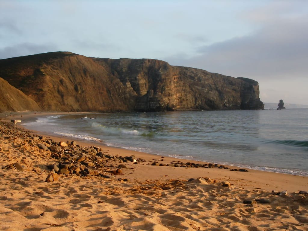
AI contentAt the foot of high cliffs, this ribbon of golden sand some 500 metres long draws surfers from the Vicentine coast. Head down from the village by a wooden staircase, near the small fishing harbour. On the northern headland, excavations of a 12th-century fortified site have uncovered three mosques.
19 Castle
Castle of Aljezur
Castelo de Aljezur
Aljezur · 8 km · 14 min
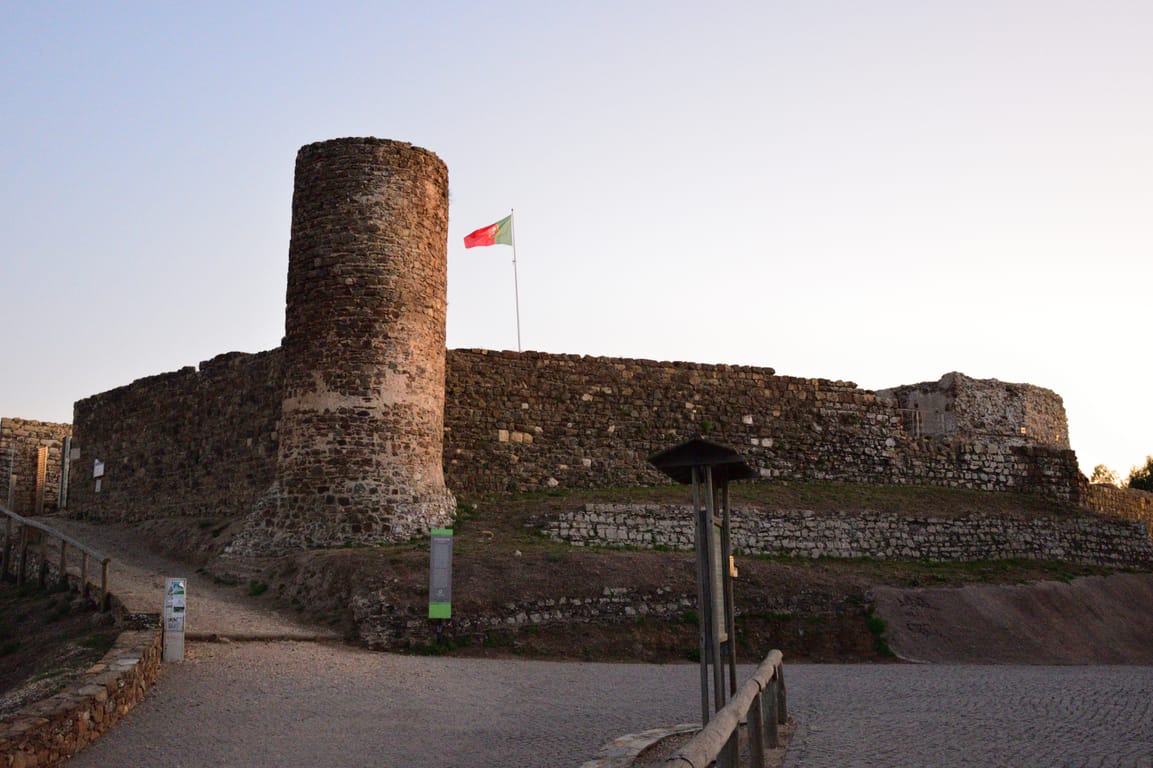
AI contentMake your way through the lanes of the old town to this castle perched at around 88 metres, which watched over the Ribeira de Aljezur, navigable until the 16th century. Its polygonal wall links a round tower to a square one, and a vaulted cistern sleeps in a corner of the courtyard. The view runs across the valley to the coast.
20 Beach · Family
Praia de Odeceixe Mar
Praia de Odeceixe
Odeceixe · 17 km · 26 min
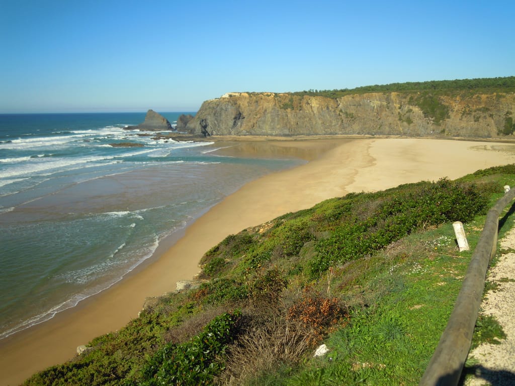
AI contentHere, the Seixe meets the Atlantic and marks the boundary between the Algarve and the Alentejo. The sand stretches along the south bank, facing the high cliffs that close off the other side of the river mouth. Walk down from the little village by the steep path, watching the river merge with the ocean beneath your feet.
The night — Booking, Park4night or Airbnb
Day 6 Odemira → Zambujeira do Mar 3 stops · 80 km · ≈ 1h29
21 Castle
Fort São Clemente
Forte de Milfontes
Odemira · 46 km · 51 min
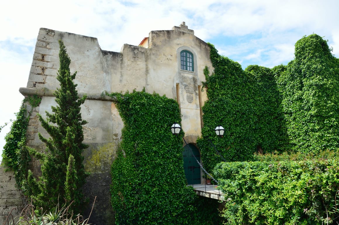
AI contentBuilt in 1602 on a rocky point, the fort guarded the mouth of the Mira against pirates. View it from the Barbacã viewpoint: ivy is creeping over its walls, and a mock crenellated turret hides a water tank. Sold to private owners in 1903, it remains a private residence.
22 Coast
Cabo Sardão
Odemira · 20 km · 23 min
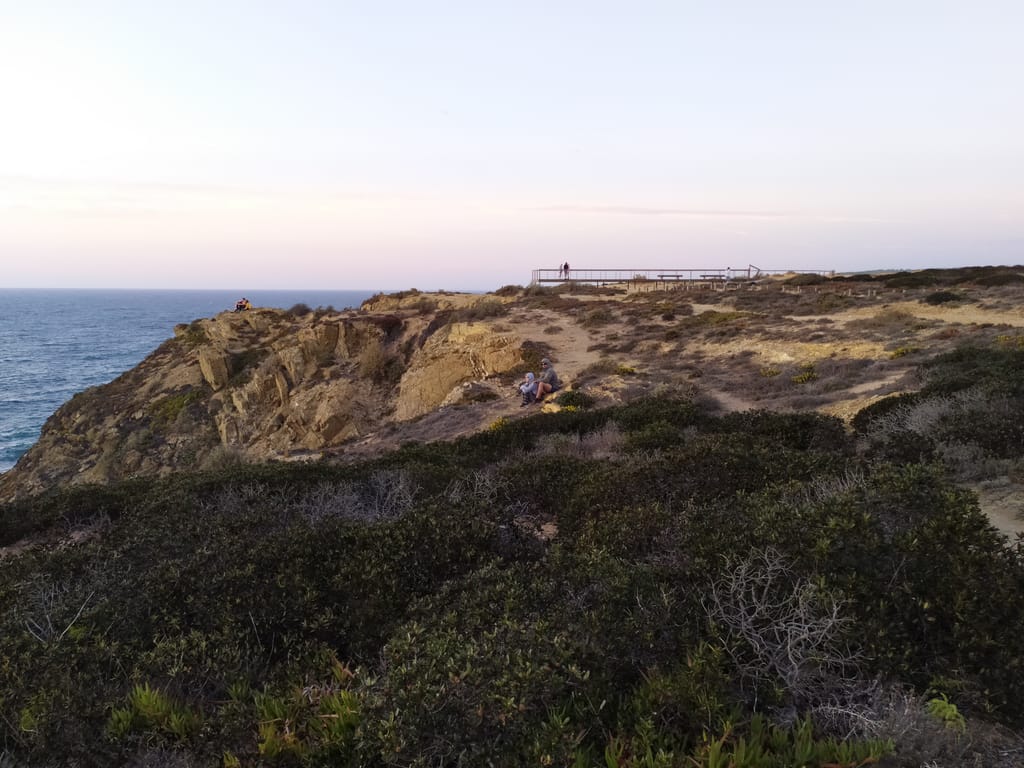
AI contentNo headland on the west coast, between Sines and Cape São Vicente, juts out further than Cape Sardão. Look for the white storks' nests clinging to the sea cliffs, a rare choice for this bird. A lighthouse watches over this shore, part of the Costa Vicentina natural park.
23 Beach · Family
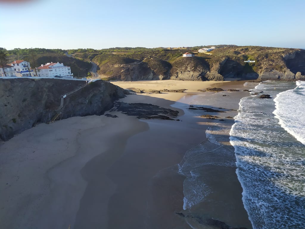
Praia da Zambujeira do Mar
Zambujeira do Mar · 14 km · 15 min
The night — Booking, Park4night or Airbnb
Day 7 Monchique → Faro 3 stops · 160 km · ≈ 2h52
24 Mountain
Foia
Monchique · 62 km · 1h09
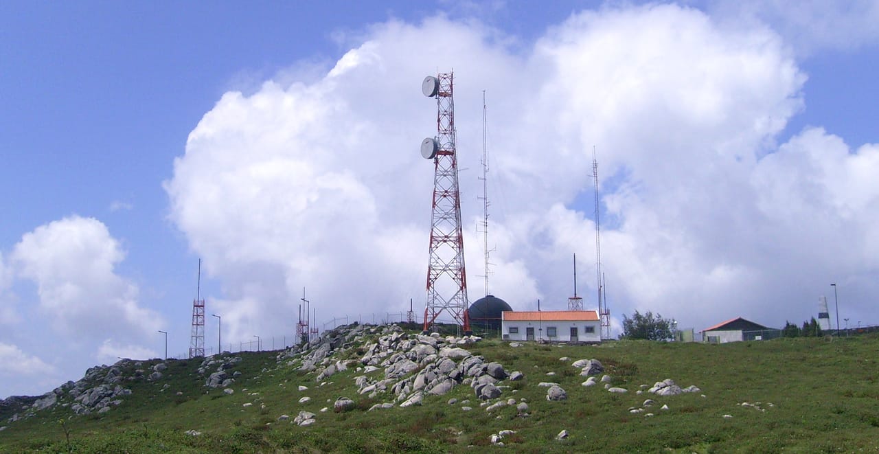
AI contentAt 902 metres, Foia is the roof of the Algarve, at the summit of the Serra de Monchique. Drive up from Monchique and, on a clear day, look for the line of the Atlantic. On 25 April 1974, officers of the revolution came to disconnect its antennas, then used by the political police.

25 Village
Caldas de Monchique
Monchique · 14 km · 22 min
AI contentOn the southern slope of the Picota, the Romans already held sacred these waters that gush out at between 27 and 31.5 degrees. Stroll among chalets with steeply pitched roofs and pointed-arch windows, built in the late 19th century. Lush vegetation envelops the hamlet, whose old inn was completed in 1692.
26 Castle
Castle of Silves
Castelo de Silves
Silves · 23 km · 33 min
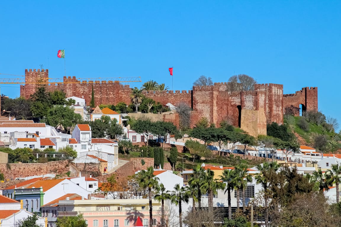
AI contentOverlooking the Arade, the alcáçova of Silves is regarded as the finest example of Islamic military architecture in Portugal, and the largest in the Algarve. Walk around its red sandstone ramparts and eleven square towers, from where the view stretches to the Serra de Monchique. Taken in 1189, lost again in 1191, the town only became Christian in 1249.
Back to Faro · 61 km · 48 min