Roadbook · by ViaLooma
St-Malo → Vannes
Featured in The coast of Brittany, from Saint-Malo to Vannes
The route — Saint-Malo → Vannes
Day 1 Saint-Malo → Plévenon 4 stops · 79 km · ≈ 1h42

01 Heritage
Remparts de Saint-Malo
Saint-Malo (35400) · 1 km · 4 min
AI contentBegun in the 12th century and largely rebuilt in the 18th by Siméon Garangeau, at Vauban's request, the ramparts enclose the corsair city for 1,754 metres. Follow their wall walk between the granite houses and the sea, as far as the old kennels of the watch mastiffs. The bombing of 1944 spared them, while the town was devastated.
02 Village
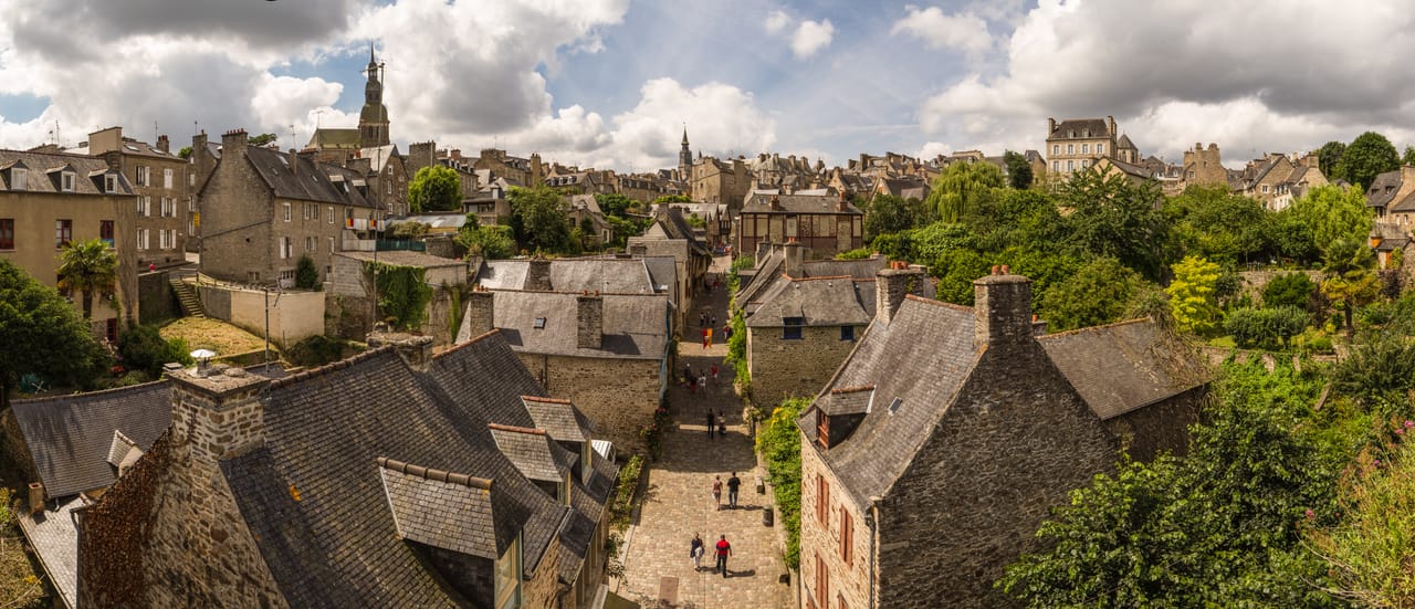
Dinan
Dinan (22100) · 33 km · 35 min
AI contentGirdled by ramparts, Dinan commands from its hill the Rance valley, which it overlooks by 75 metres. You head down to the port by the Rue du Jerzual, steep and lined with half-timbered houses. At the water's edge, where Dinan long offered the last bridge before the estuary, the town reveals itself in tiers up the slope.
03 Castle
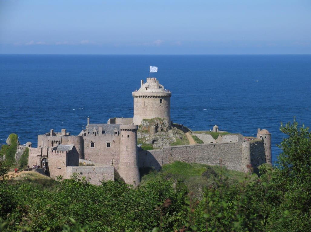
Fort la Latte
Plévenon (22240) · 41 km · 58 min
AI contentOn a rocky spur near Cap Fréhel, this 14th-century castle watches over the Bay of Saint-Malo. Cross two drawbridges, one of which spans a fissure several metres wide, before reaching the courtyard and its keep. Besieged by Du Guesclin and restored from 1931, it has lent its walls to several film shoots.
04 Coast
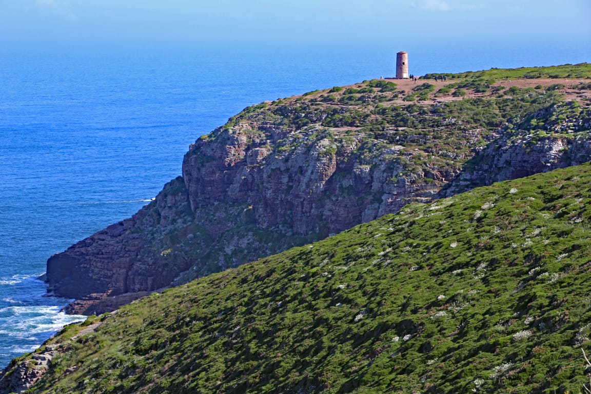
Cap Fréhel
Plévenon (22240) · 4 km · 5 min
AI contentRising between the bays of Saint-Brieuc and Saint-Malo, this headland of pink sandstone drops into the English Channel from a height of around seventy metres. Follow the coastal path between heather and gorse, with the Fauconnière stack and its seabirds below. On a clear day, Jersey appears on the horizon.
The night — Booking, Park4night or Airbnb
Day 2 Paimpol → Perros-Guirec 3 stops · 136 km · ≈ 2h33
05 Village
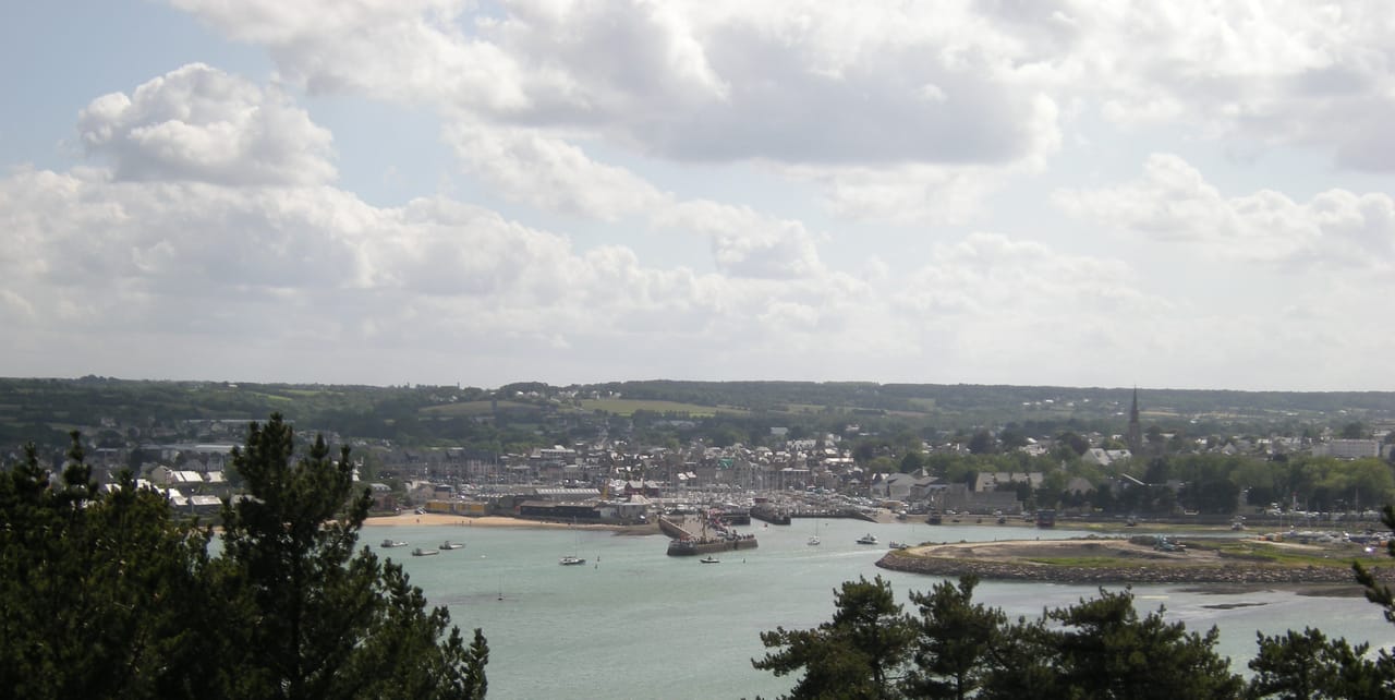
Paimpol
Paimpol (22500) · 95 km · 1h32
AI contentAt the head of its bay, near the Trieux estuary, Paimpol grew up around docks where fishing boats and yachts lie side by side. At low tide, you can walk round the Pointe de Guilben to see pillow lavas 640 million years old. The port keeps alive the memory of the Iceland fishermen Pierre Loti wrote about.
06 Village
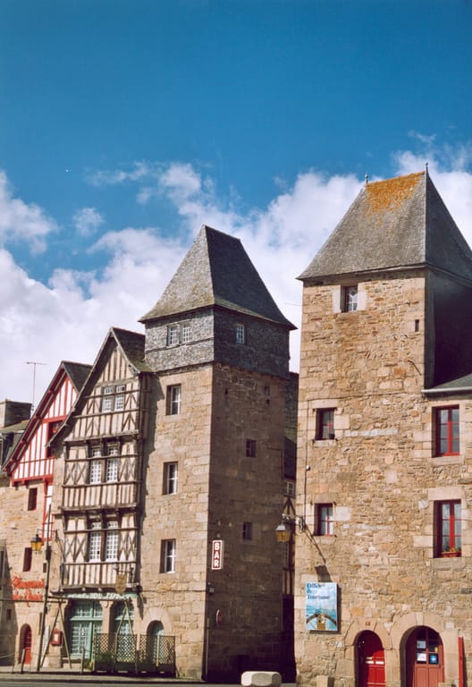
Tréguier
Tréguier (22220) · 16 km · 24 min
AI contentA former bishopric and historic capital of the Trégor, Tréguier occupies the promontory where the Jaudy and the Guindy meet in a broad ria. Stroll through its lanes lined with half-timbered houses to the square before the Cathédrale Saint-Tugdual. Below, the estuary-head harbour, nine kilometres from the sea, mainly welcomes pleasure boats.
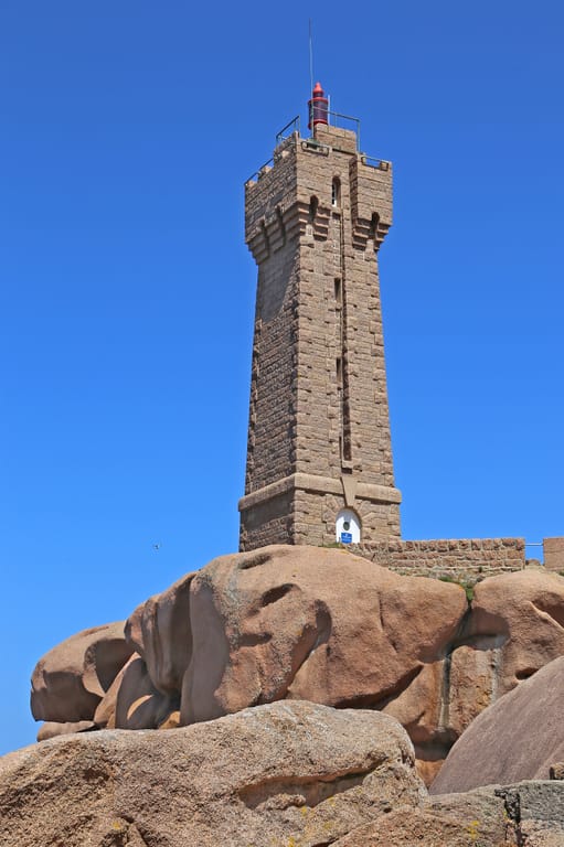
07 Monument
Ploumanac'h Lighthouse
Phare de Ploumanac'h
Perros-Guirec (22700) · 25 km · 37 min
AI contentOn the pink rocks, the Men Ruz lighthouse was rebuilt in red granite from the La Clarté quarries, after German troops blew up the first one in August 1944. You approach it along the coastal path, without being able to go inside. From there, the view runs out to the Château de Costaérès and the Sept-Îles archipelago.
The night — Booking, Park4night or Airbnb
Day 3 Plouezoc'h → Saint-Thégonnec Loc-Eguiner 3 stops · 83 km · ≈ 1h47
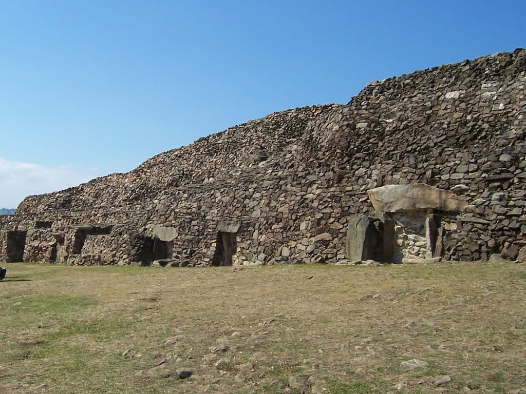
08 Archaeology
Barnenez
Cairn de Barnenez
Plouezoc'h (29252) · 53 km · 1h13
AI contentOn a promontory overlooking the Bay of Morlaix, discover a long dry-stone cairn built around 4700 BC. Its 75 metres hold eleven passage graves, and the façade shifts from dark dolerite to pale granite. Damaged by a quarry in 1955, it ranks among the oldest monuments in Europe.
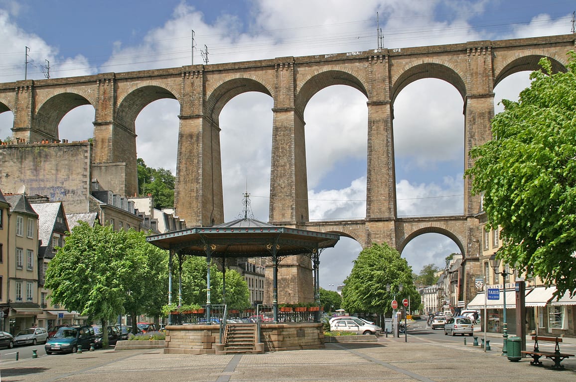
09 Monument
Morlaix viaduct
Viaduc de Morlaix
Morlaix (29600) · 14 km · 18 min
AI contentSixty-two metres high, this stone viaduct with two tiers of arches spans the very heart of Morlaix, which the town council feared would be smothered. From the streets, watch for the trains on the Paris-Brest line passing above the rooftops. In January 1943, a single British bomb struck it, opening a breach that was quickly repaired.

10 Heritage
Saint-Thégonnec Parish close
Enclos paroissial de Saint-Thégonnec
Saint-Thégonnec Loc-Eguiner (29410) · 16 km · 16 min
AI contentIn the heart of the town, a Renaissance triumphal arch in granite, completed in 1589, opens onto the enclosure of the church of Notre-Dame. Here, see an ossuary built from 1676 to 1682 and a calvary of 1610, the latest of the great enclosure calvaries. Ravaged by fire in 1998, the church has been restored identically.
The night — Booking, Park4night or Airbnb
Day 4 Camaret-sur-Mer 2 stops · 93 km · ≈ 1h54
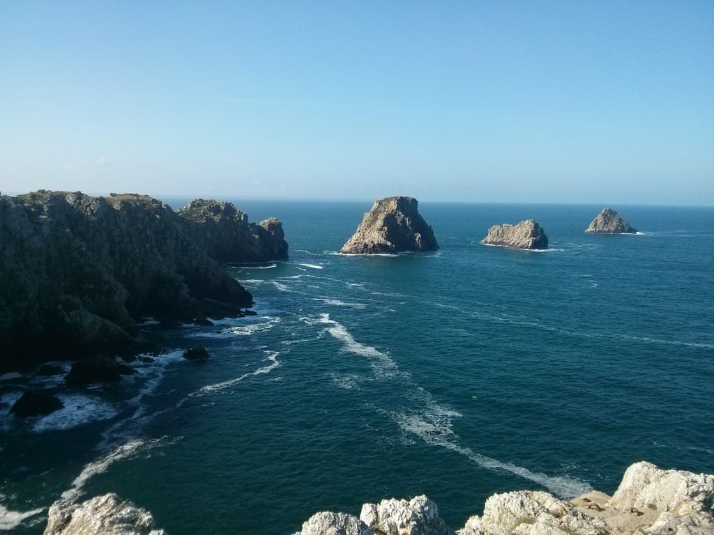
11 Coast
Pointe de Pen-Hir
Camaret-sur-Mer (29570) · 77 km · 1h34
AI contentAt the end of the peninsula, the pale Armorican sandstone cliffs of Pen-Hir drop sheer for some 70 metres. Below, the Tas de Pois line up their rocks out to sea. On a clear day, you can make out the Île de Sein, the Pointe du Raz, Ouessant and the Pointe Saint-Mathieu.
12 Coast
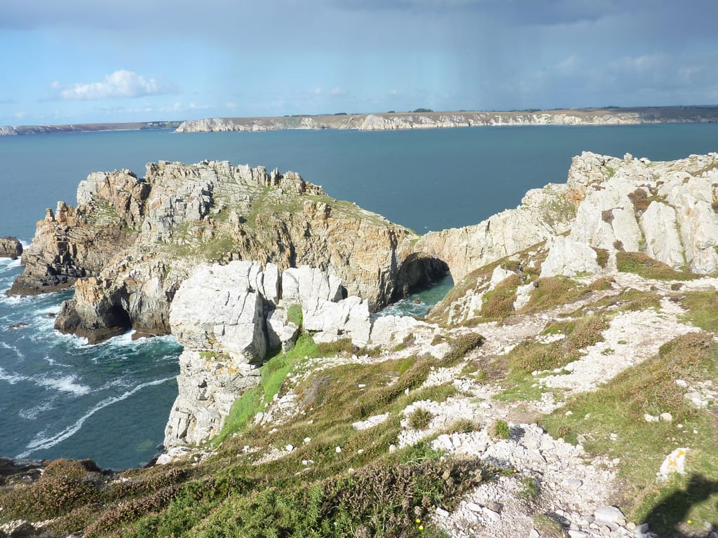
Pointe de Dinan
Camaret-sur-Mer · 16 km · 20 min
AI contentAt the tip of the headland, a mass of sandstone forms a ruined castle, with a natural arch serving as its drawbridge. On a clear day, take the path to look out over the Iroise Sea, the Tas de Pois and, to the north, Brest. At low tide, this sandstone castle can also be admired from Kerloc'h beach.
The night — Booking, Park4night or Airbnb
Day 5 Locronan → Cléden-Cap-Sizun 3 stops · 90 km · ≈ 2h
13 Village
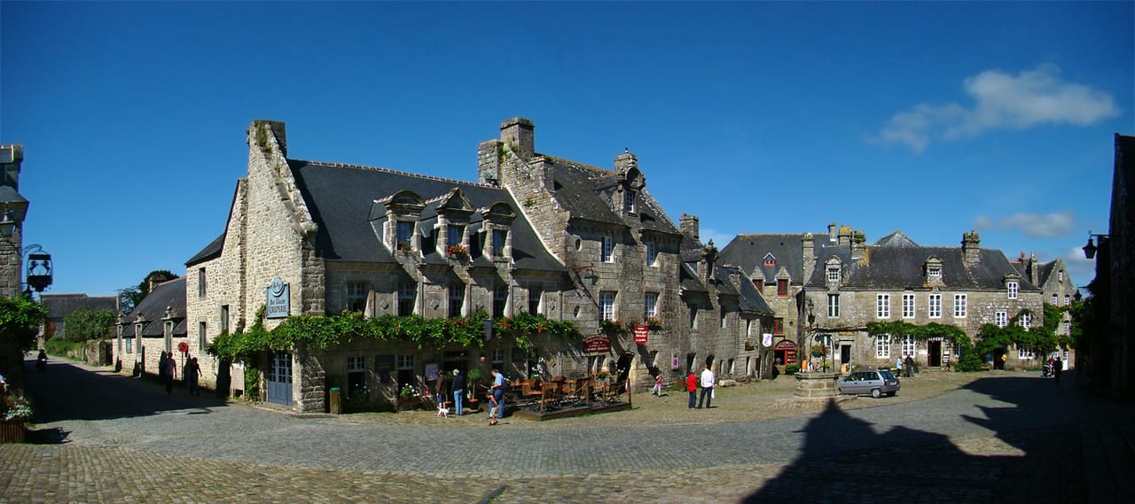
Locronan
Locronan (29180) · 40 km · 54 min
AI contentStep onto a cobbled square where an old well faces the church of Saint-Ronan and the granite Renaissance houses topped with slate. These prosperous façades speak of the fortune the town once made from the sailcloth trade. From Plas ar Horn, above the town, a wide panorama opens over the Bay of Douarnenez and the Ménez-Hom.
14 Coast
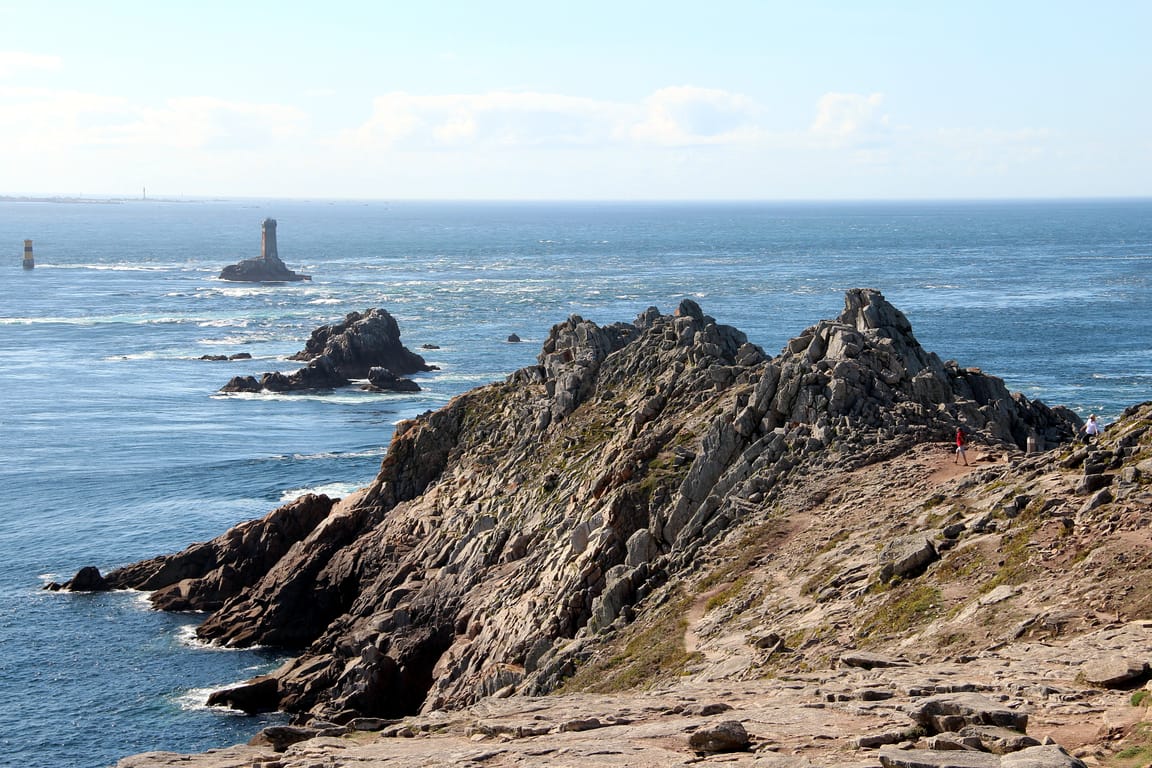
Pointe du Raz
Plogoff (29770) · 44 km · 57 min
AI contentAt the far western end of Cap Sizun, the point thrusts its granite prow 72 metres above the Raz de Sein, with its feared currents. Walk among the heather, which has returned after decades of trampling, out to the point facing the Île de Sein. The shops and hotels that covered the headland were demolished in 1996 and 1997.
15 Coast
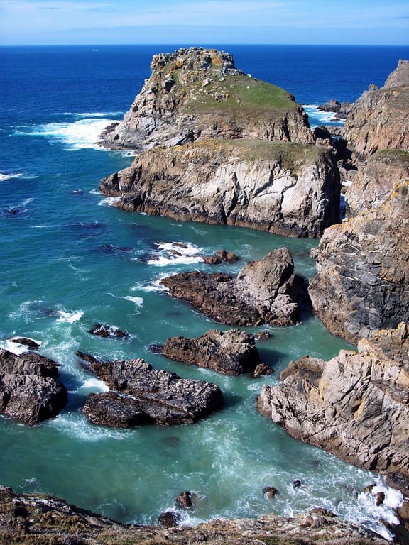
Pointe du Van
Cléden-Cap-Sizun (29770) · 6 km · 9 min
AI contentLeave the crowds at the Pointe du Raz and walk to the Pointe du Van, which closes the Baie des Trépassés to the north. Its softer rock, gnawed by the swell, breaks into multiple headlands, so that the tip seems to slip away with every step. Near the chapel of Saint-They, large isolated blocks stand out against the Iroise Sea.
The night — Booking, Park4night or Airbnb
Day 6 Penmarc'h → Pont-Aven 4 stops · 140 km · ≈ 2h51
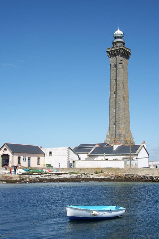
16 Monument
Penmarc'h Lighthouse
Phare d'Eckmühl
Penmarc'h (29760) · 60 km · 1h14
AI contentWatch this tower of Kersanton granite, more than sixty metres high, rise opposite the reefs of Penmarc'h. Its name honours Davout, Prince of Eckmühl, whose daughter wished, through this bequest, to redeem the tears of war with lives saved. Inaugurated in 1897, it hides a stairwell whose walls are lined with opaline.
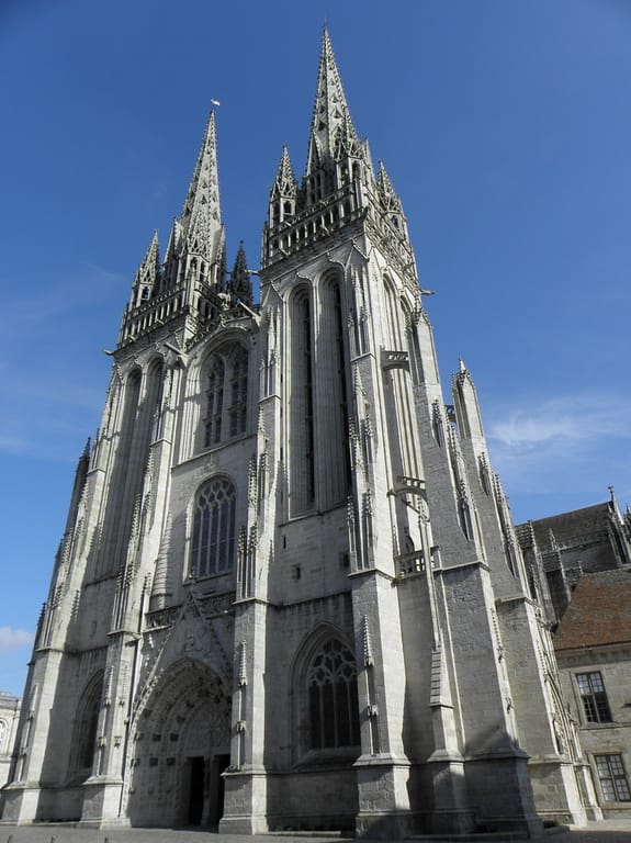
17 Church
Quimper Cathedral
Cathédrale Saint-Corentin de Quimper
Quimper (29000) · 34 km · 40 min
AI contentBegun in the 13th century, Quimper's great cathedral only received its spires under the Second Empire, after six centuries of construction. Between them, spot the equestrian statue of the legendary King Gradlon, perched high on the façade. Inside, the choir veers noticeably off the axis of the nave, a singular feature of the building.

18 Village
Concarneau
Concarneau (29900) · 26 km · 29 min
AI contentConcarneau was born on a fortified island in the Moros estuary, the Ville Close, linked to the mainland by a defended bridge. Around it grew France's seventh-largest fishing port, lined with shipyards. Watch for the spring tides on the Sables-Blancs beach, when seventeen oak trunks emerge from the sand.
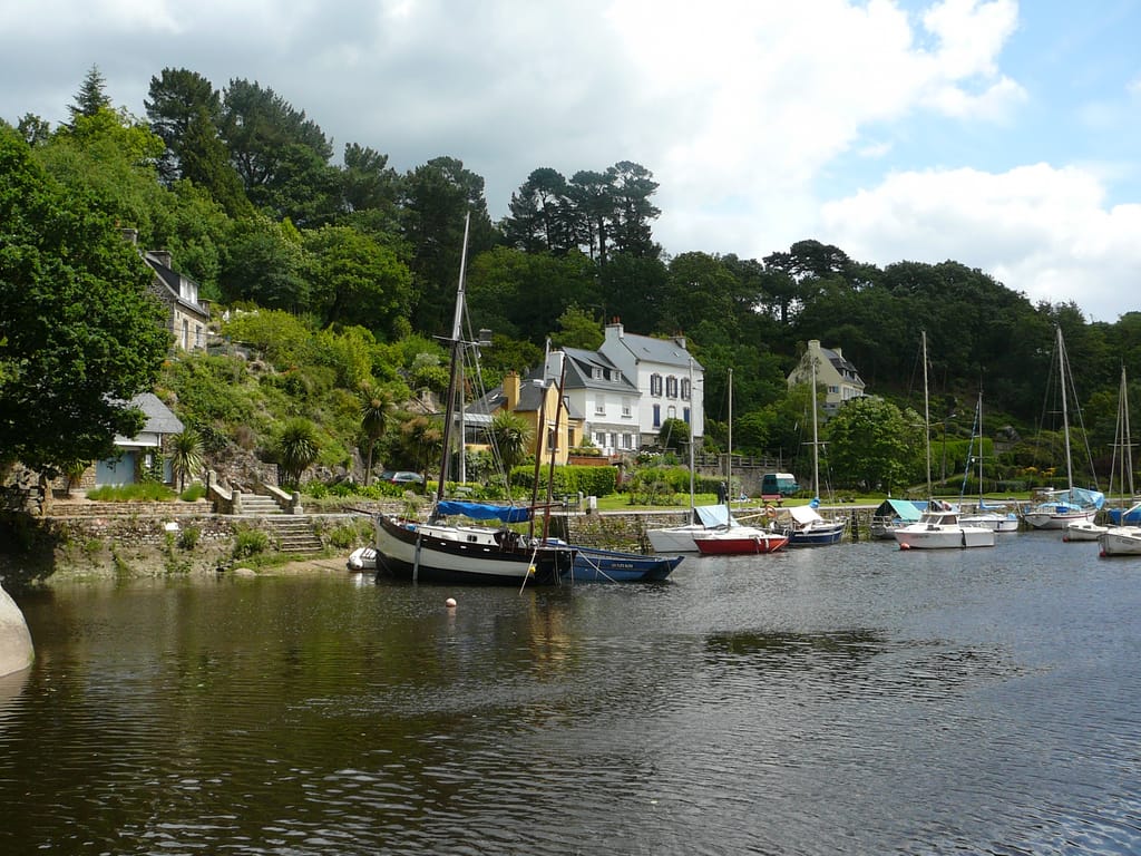
19 Village
Pont-Aven
Pont-Aven (29930) · 20 km · 28 min
AI contentAt the last bridge before the sea, the Aven leaves its jumble of rocks to widen into a ria, and this current once turned the town's mills. Follow the banks and the stone channels that fed them. Gauguin and Émile Bernard stayed here, and the little town still bears the nickname of the city of painters.
The night — Booking, Park4night or Airbnb
Day 7 Belz → Carnac 3 stops · 104 km · ≈ 2h07

20 Island
Île de Saint-Cado
Belz (56550) · 63 km · 57 min
AI contentA causeway bridge, freely open to pedestrians, links this island in the Rivière d'Étel to the shore. Cross over to the 12th-century Romanesque chapel, the 1832 calvary and the holy well. All around, the waters of the ria rise and fall with the tide, along the jetty where the boats of the sardine port once moored.

21 Nature
Côte Sauvage de la presqu'île de Quiberon
Saint-Pierre-Quiberon (56510) · 24 km · 41 min
AI contentOn the west side of the peninsula, eight kilometres of cliffs run from the Pointe du Percho to the Château Turpault. Higher in the north, beneath perched dunes, they drop towards the south into close-cropped grassland cut by low stone walls. Walk along this great coast keeping well back from the edge, as the waves often sweep walkers away here.
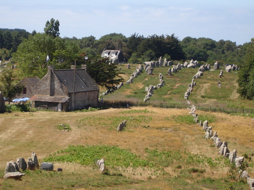
22 Archaeology
Carnac stones
Alignements de Carnac
Carnac (56340) · 17 km · 29 min
AI contentNearly three thousand menhirs, raised around 4500 BC, stand in lines here over more than four kilometres. Follow these rows of granite whose height gradually decreases, like a frozen procession. After so many theories, from Roman camp to druid temple, Flaubert settled the matter with wit: they are big stones.
The night — Booking, Park4night or Airbnb
Day 8 Locmariaquer → Vannes 2 stops · 46 km · ≈ 58 min
23 Archaeology
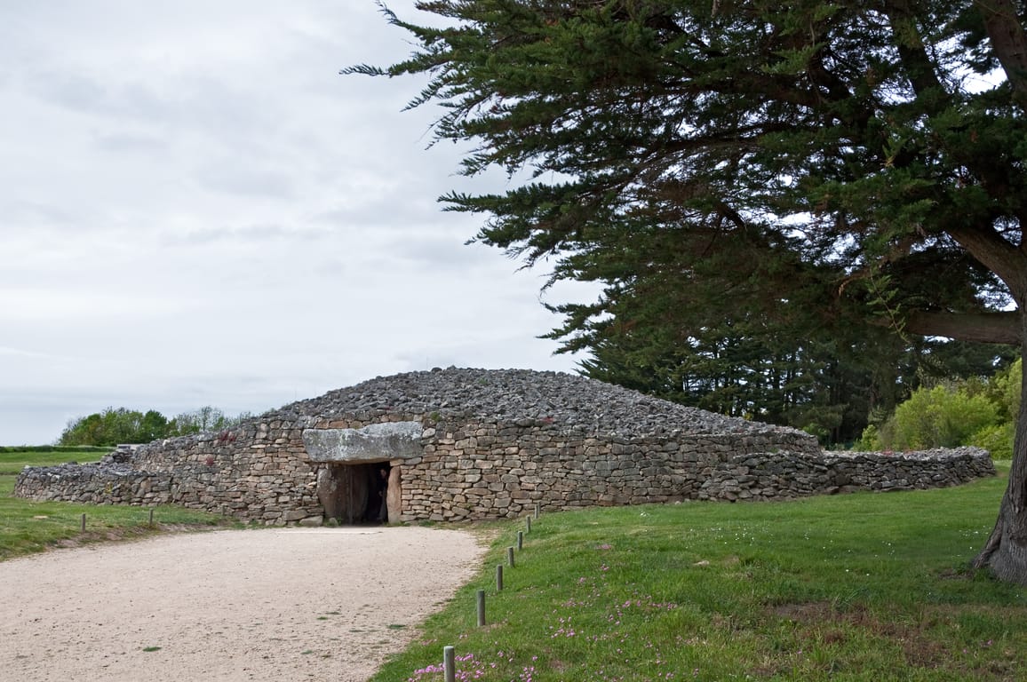
Table des Marchands
Locmariaquer (56740) · 14 km · 21 min
AI contentAt Locmariaquer, this passage grave, just over ten metres long, carries a capstone 5.72 metres long. Its cairn, rebuilt in 1991, replaces a 1937-1938 restoration that caused controversy as far as Paris. Step into the chamber to see the back slab, engraved with crook-shaped motifs.

24 Castle
Ramparts of Vannes
Remparts de Vannes
Vannes (56000) · 31 km · 34 min
AI contentWalk along these ramparts that protected Vannes from the 3rd to the 17th century, among the few urban fortifications still standing in Brittany. Duke John IV had them extended southwards at the end of the 14th century, doubling the walled town. The Bourreau, Poudrière and Joliette towers were added around the middle of the following century.
Arrival in Vannes · 1 km · 3 min
The night — Booking, Park4night or Airbnb