Roadbook · by ViaLooma
Pau → Bagnères-de-Luchon
Featured in The Pyrenees by the passes, from Pau to Luchon
The route — Pau → Bagnères-de-Luchon
Day 1 Pau → Arbéost 4 stops · 70 km · ≈ 1h46
01 Castle
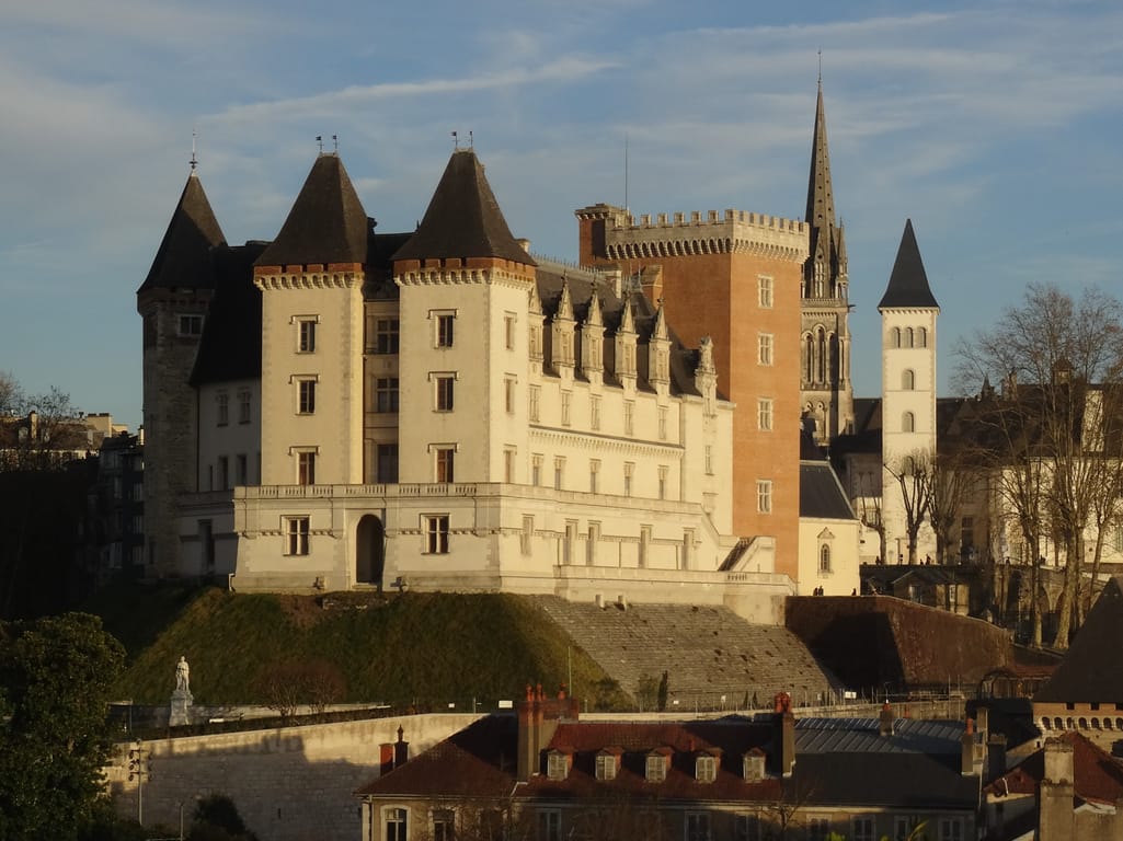
Château de Pau
Pau (64000) · 4 km · 9 min
AI contentDiscover, on a spur above the gave, the castle where Henri IV was born. Gaston Fébus fortified it towards the end of the 14th century, then the kings of Navarre embellished it during the Renaissance. Its museum displays a tortoise shell which, tradition says, served as his cradle.
02 Mountain
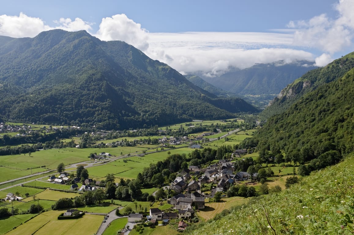
Ossau Valley
Vallée d'Ossau
Laruns (64440) · 40 km · 58 min
AI contentThe Vallée d'Ossau links Rébénacq to the Col du Pourtalet, over some fifty kilometres. Carved by a now-vanished glacier, it lives beneath the silhouette of the Pic du Midi d'Ossau, 2,884 metres high. Heading up the gave, you can see the villages pressing their narrow streets against the slope.
03 Mountain
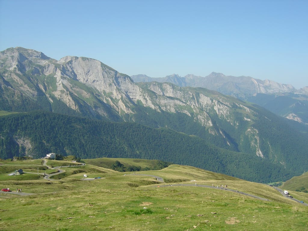
Col d'Aubisque
Béost (64440) · 16 km · 24 min
AI contentAt 1,709 metres, the Col d'Aubisque has the Pic de Ger as its neighbour to the south, and the road runs as a corniche towards the Soulor above the Cirque du Litor. Follow with your eyes this spa road commissioned by Empress Eugénie and completed in 1864. The Tour de France crossed the pass as early as 1910, on its first great Pyrenean stage.
04 Mountain
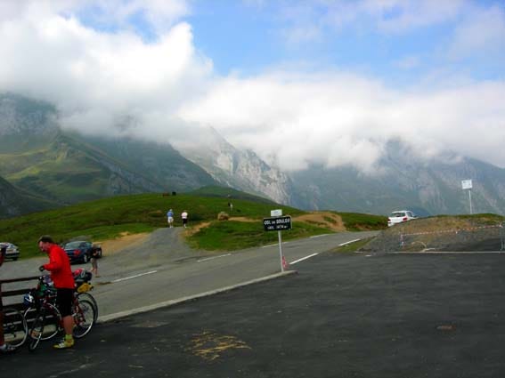
Col du Soulor
Arbéost (65560) · 10 km · 15 min
AI contentAt 1,471 metres, the Col du Soulor links the Ouzoum valley to the Val d'Azun, on the road running from Laruns to Argelès-Gazost. The Tour de France has crossed it since 1910, often paired with the nearby Col d'Aubisque. Take time to look south-west, where the Pic de Gabizos rises.
The night — Booking, Park4night or Airbnb
Day 2 Saint-Savin → Cauterets 2 stops · 43 km · ≈ 55 min
05 Abbey
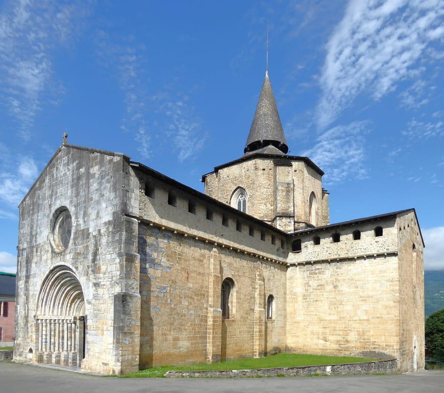
Abbey of Saint-Savin-en-Lavedan
Abbaye de Saint-Savin-en-Lavedan
Saint-Savin (65400) · 21 km · 27 min
AI contentThe church of Saint-Savin, now a parish church, holds what survives of an abbey that ranked among the great religious centres of Bigorre. The Romanesque monastery, recorded from the 10th century, was shaken by the earthquakes of 1660 and 1854, and its buildings were sold as national property. Prosper Mérimée had the abbey church restored in 1855.
06 Nature park
Pont d'Espagne
Cauterets (65110) · 22 km · 28 min
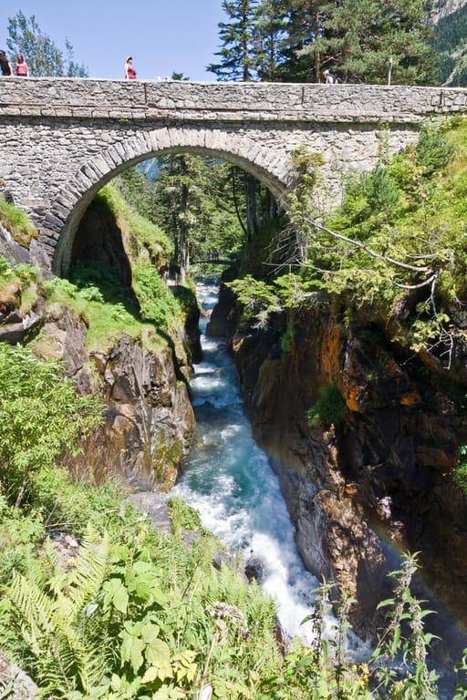
AI contentAt the Pont d'Espagne, at 1,496 metres, the Marcadau and Gaube streams meet in a series of lively waterfalls. Leave the car in the car park and carry on on foot, by the road or by a path with footbridges. This old route into Spain, given back to walkers, also leads to the Lac de Gaube.
The night — Booking, Park4night or Airbnb
Day 3 Luz-Saint-Sauveur → Gavarnie-Gèdre 2 stops · 51 km · ≈ 1h04

07 Village
Luz-Saint-Sauveur
Luz-Saint-Sauveur (65120) · 31 km · 40 min
AI contentLuz-Saint-Sauveur was built on the alluvial fan of the Yse torrent, near the confluence of the Bastan and the Gave de Gavarnie. At the heart of the village stands a fortified Romanesque church, ringed by a crenellated wall. Take time to walk around its enclosure before heading up the valley towards Gavarnie.

08 Village
Gavarnie
Gavarnie-Gèdre (65120) · 20 km · 24 min
AI contentNear the Spanish border, Gavarnie guards the entrance to its World Heritage cirque, where a 422-metre waterfall gives rise to the Gave de Pau. Its church, a former priory of the Hospitallers, watches over the Pyreneists' plot and the graves of the Passet guides. Along the way, you'll also come across the effigy of Count Henry Russell.
The night — Booking, Park4night or Airbnb
Day 4 Bagnères-de-Bigorre 2 stops · 41 km · ≈ 52 min
09 Mountain
Col du Tourmalet
Bagnères-de-Bigorre (65200) · 39 km · 49 min
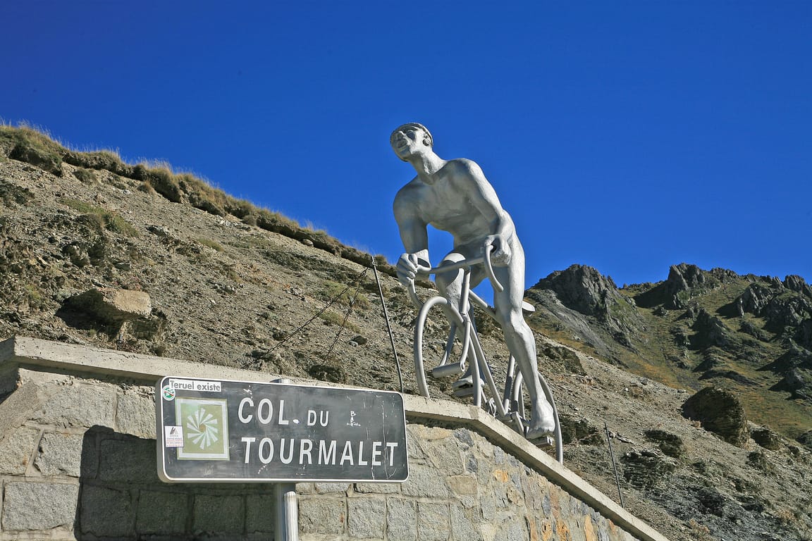
AI contentTake the time to catch your breath at the summit, at 2,115 metres, facing the Pic du Midi de Bigorre that closes the horizon. Madame de Maintenon passed this way as early as 1675 with the young Duke of Maine, on the way to the baths of Barèges. Funded by Napoleon III and opened in 1864, the road has become a legendary pass of the Tour de France.
10 Mountain
Pic du Midi de Bigorre
Bagnères-de-Bigorre (65200) · 2 km · 3 min
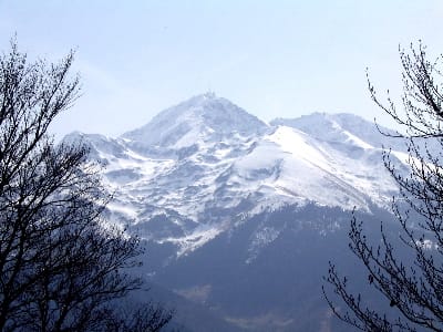
AI contentSet forward from the main range, this Bigorre peak carries an observatory on a summit where the astronomer Plantade was already following the eclipse of 1706. A cable car climbs up from La Mongie in two stages. On a clear day, let your gaze roam across the Pyrenees, from the Basque coast to the peaks of the Ariège.
The night — Booking, Park4night or Airbnb
Day 5 Aspin-Aure → Bagnères-de-Luchon 3 stops · 89 km · ≈ 1h37
11 Mountain
Col d'Aspin
Aspin-Aure (65240) · 32 km · 34 min
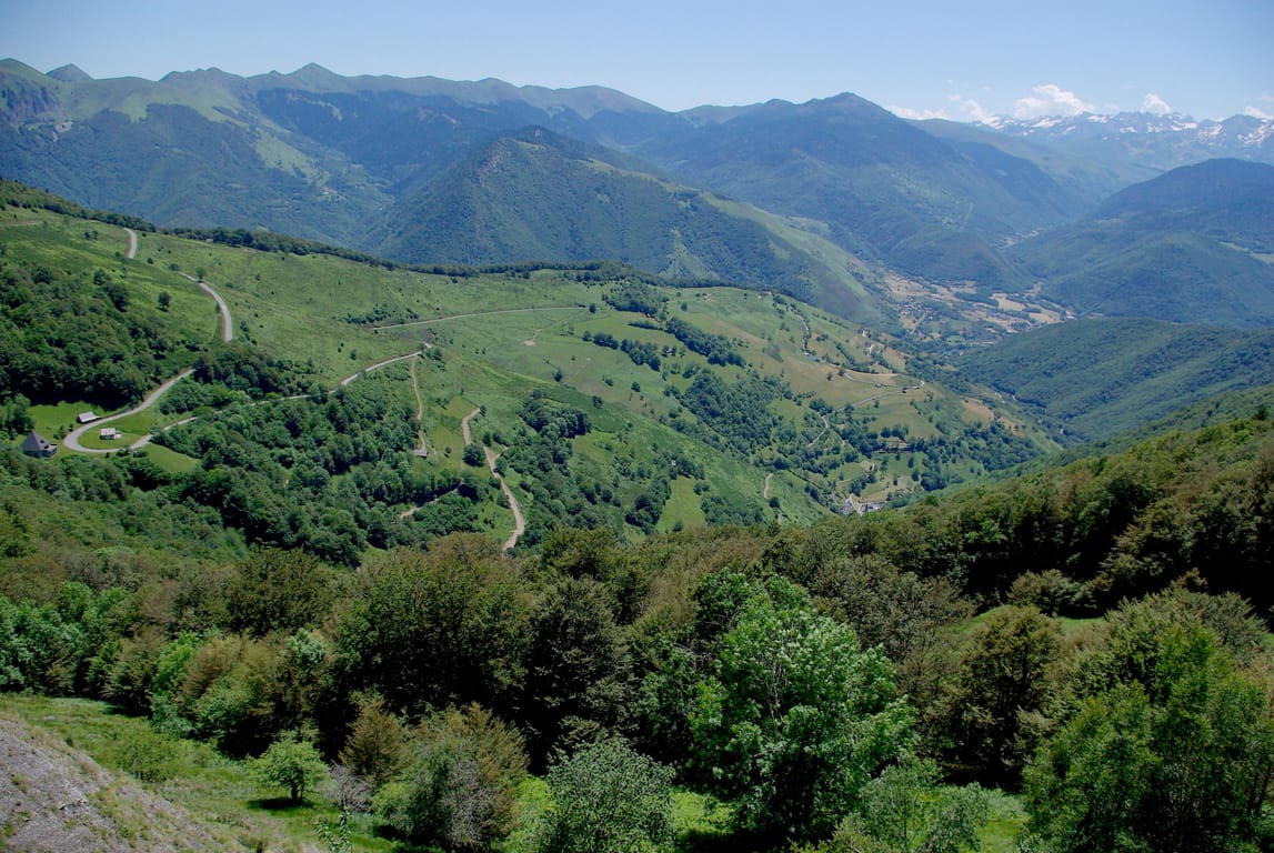
AI contentBetween the Campan and Aure valleys, the Col d'Aspin is crossed at the end of long Pyrenean hairpins. Follow a road the Tour de France has taken seventy-eight times, with the Lac de Payolle below. The Campan side is covered in conifer forest, the Aure side in meadows dotted with broadleaf trees.
12 Mountain
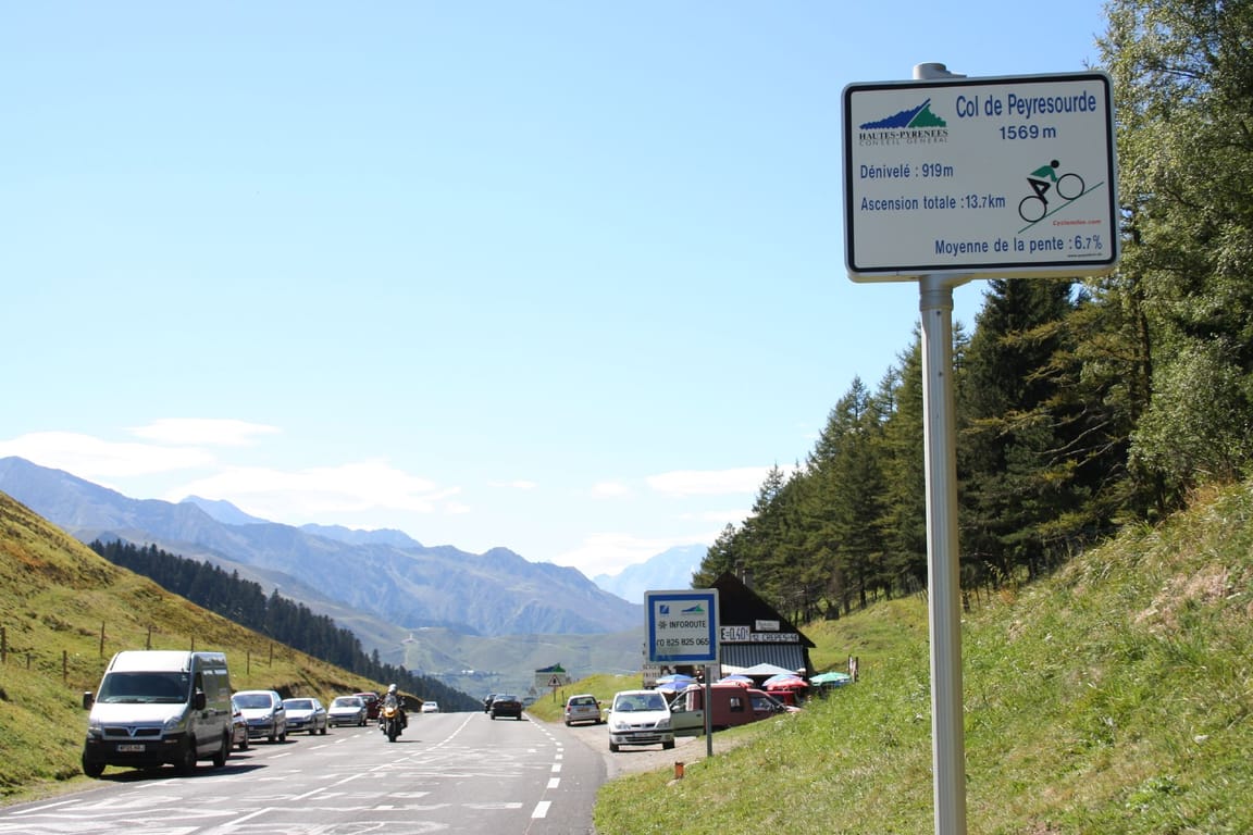
Col de Peyresourde
Loudervielle (65240) · 31 km · 31 min
AI contentClimb to the top of the Col de Peyresourde, at 1,569 metres, where the road tips over from the Louron towards Luchon. The pass marks the boundary between the Hautes-Pyrénées and the Haute-Garonne, on an ancient crossing often climbed by the Tour de France. All around, the summer pastures roll out broad, wind-swept grassy slopes.
13 Lake
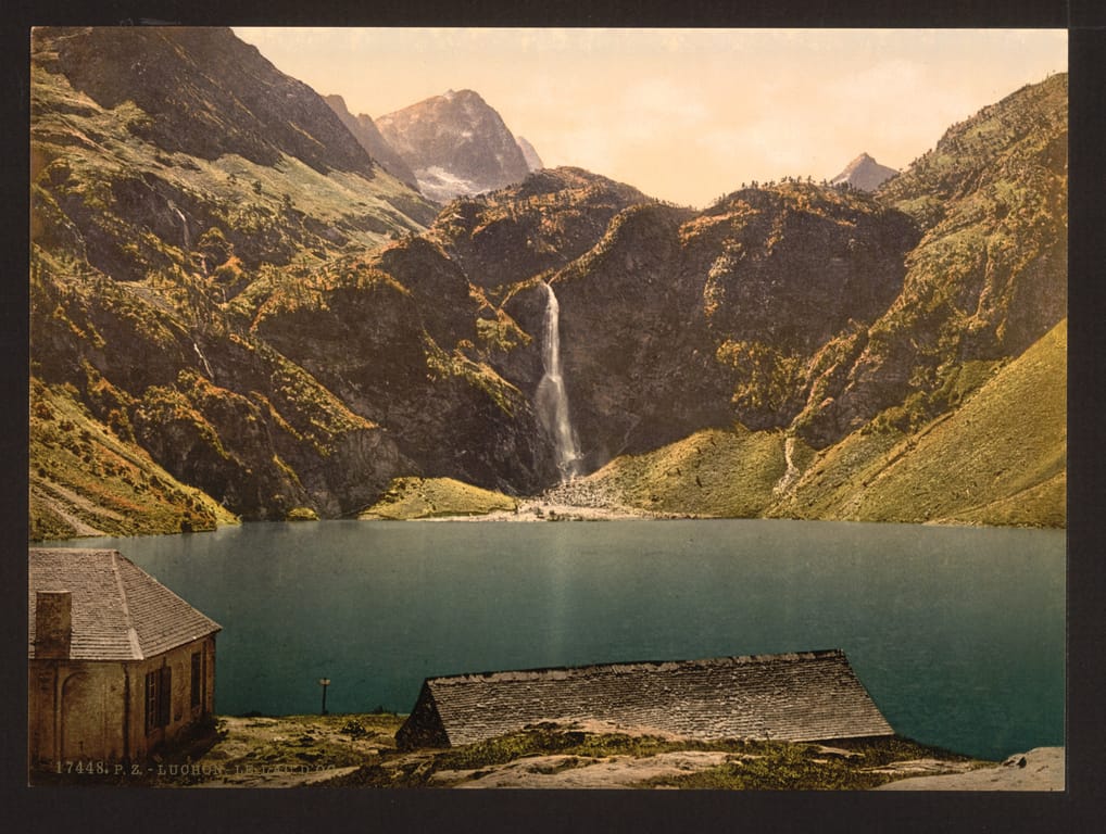
Lac d'Oô
Oô (31110) · 13 km · 15 min
AI contentAt 1,507 metres, this glacial lake, raised by a dam completed in 1921, is fed by a waterfall two hundred and seventy-five metres high. The GR 10 leads there in about an hour from the Granges d'Astau, at the end of the Oô valley road. Watch the falls plunge into the lake, opposite the refuge beside the dam.
Arrival in Bagnères-de-Luchon · 13 km · 17 min
The night — Booking, Park4night or Airbnb