Roadbook · by Claire

Petit Belvedère du Viso → Col d'Izoard
The route — Petit Belvedère du Viso → Col d'Izoard
Day 1 Abriès-Ristolas → Saint-Véran 2 stops · 33 km · ≈ 46 min
01 Viewpoint
Petit Belvedère du Viso
Abriès-Ristolas (05460) · 0 km · 0h
02 Village
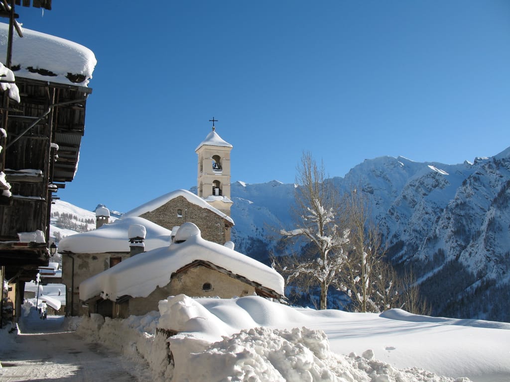
Saint-Véran
Saint-Véran (05350) · 33 km · 46 min
AI contentPerched at 2,042 metres in the Queyras, Saint-Véran is said to be the highest commune in Europe. Its larch houses, wooden haylofts on stone bases, rise in tiers facing the sun. As you walk up the street, watch the painted sundials answer one another from façade to façade; the church's bears a motto about the local rye bread.
The night — Booking, Park4night or Airbnb
Day 2 Molines-en-Queyras → Château-Ville-Vieille 2 stops · 15 km · ≈ 23 min
03 Museum
Musée de l'Abeille
Molines-en-Queyras (05350) · 6 km · 11 min
04 Castle
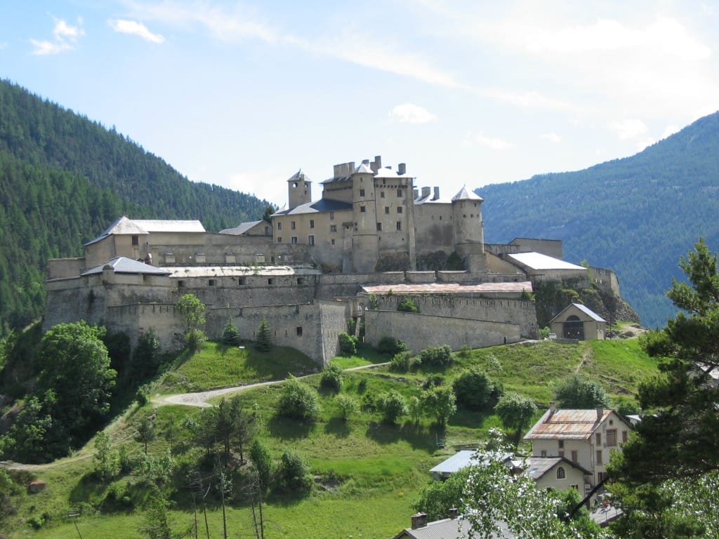
Fort Queyras
Château-Ville-Vieille (05350) · 9 km · 12 min
AI contentPerched on a glacial rock bar, Fort Queyras has blocked the Guil valley since the 13th century. After withstanding Savoyard troops in 1695, the castle received from Vauban a new enclosure, with a ditch and a demi-lune. Look up at its walls from the village of Château-Queyras, nestled at their foot.
The night — Booking, Park4night or Airbnb
Day 3 Ceillac → Molines-en-Queyras 2 stops · 52 km · ≈ 48 min

05 Village
Ceillac
Ceillac (05600) · 22 km · 19 min
AI contentAt 1,640 metres, Ceillac occupies a glacial valley in the Queyras. Two roads lead off from it, one towards the Cristillan valley, the other towards the Mélézet, beneath peaks that often exceed 3,000 metres. Among them, pick out the Pic de la Font-Sancte, the commune's highest point at 3,385 metres.

06 Village
Molines-en-Queyras
Molines-en-Queyras (05350) · 30 km · 29 min
AI contentSeven hamlets make up the commune, including Fontgillarde at 1,990 metres, along the Aigue Agnelle that flows down from the Col Agnel, on the Italian border. Their past lives on in the transitons, registers kept by village families between 1469 and 1908, recording fires, epidemics and passing troops. Come back in autumn, when the larches turn russet above the roofs.
The night — Booking, Park4night or Airbnb
Day 4 Maddalena → Molines-en-Queyras 2 stops · 49 km · ≈ 1h09
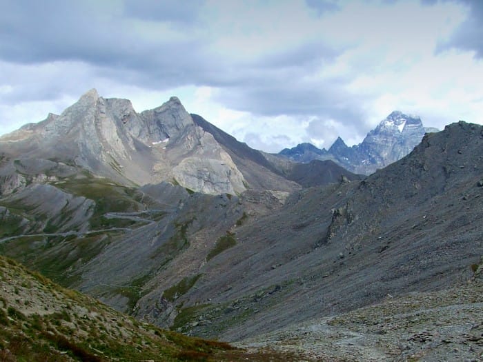
07 Mountain
Col Agnel
Colle dell'Agnello
Maddalena · 15 km · 18 min
AI contentItaly's second-highest road pass, it links Pontechianale with the Queyras by a road surfaced in 1973. On the Italian side, sixteen hairpins climb between cliffs and ravines, and from the top the west face of Monviso comes into view. Wait for nightfall at the summit, beneath a very dark sky that amateur astronomers drive up here to enjoy.

08 Mountain
Sommet Bucher
Molines-en-Queyras (05350) · 34 km · 51 min
AI contentYou climb to the Sommet Bucher by the old military road built in 1892 by the Chasseurs Alpins to supply the artillery batteries on the summit. At the top, near a small military building, the French Alpine Club's viewpoint indicator, inaugurated in 1922, comes in two parts. The view reaches the peaks of the Écrins, above the Guil valley.
The night — Booking, Park4night or Airbnb
Day 5 Arvieux → Mont-Dauphin 2 stops · 57 km · ≈ 1h27
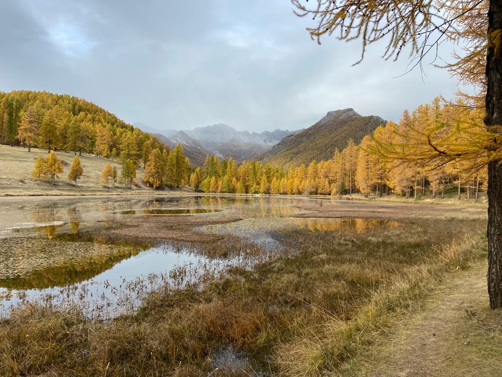
09 Lake
Lac de Roue
Arvieux (05350) · 22 km · 39 min
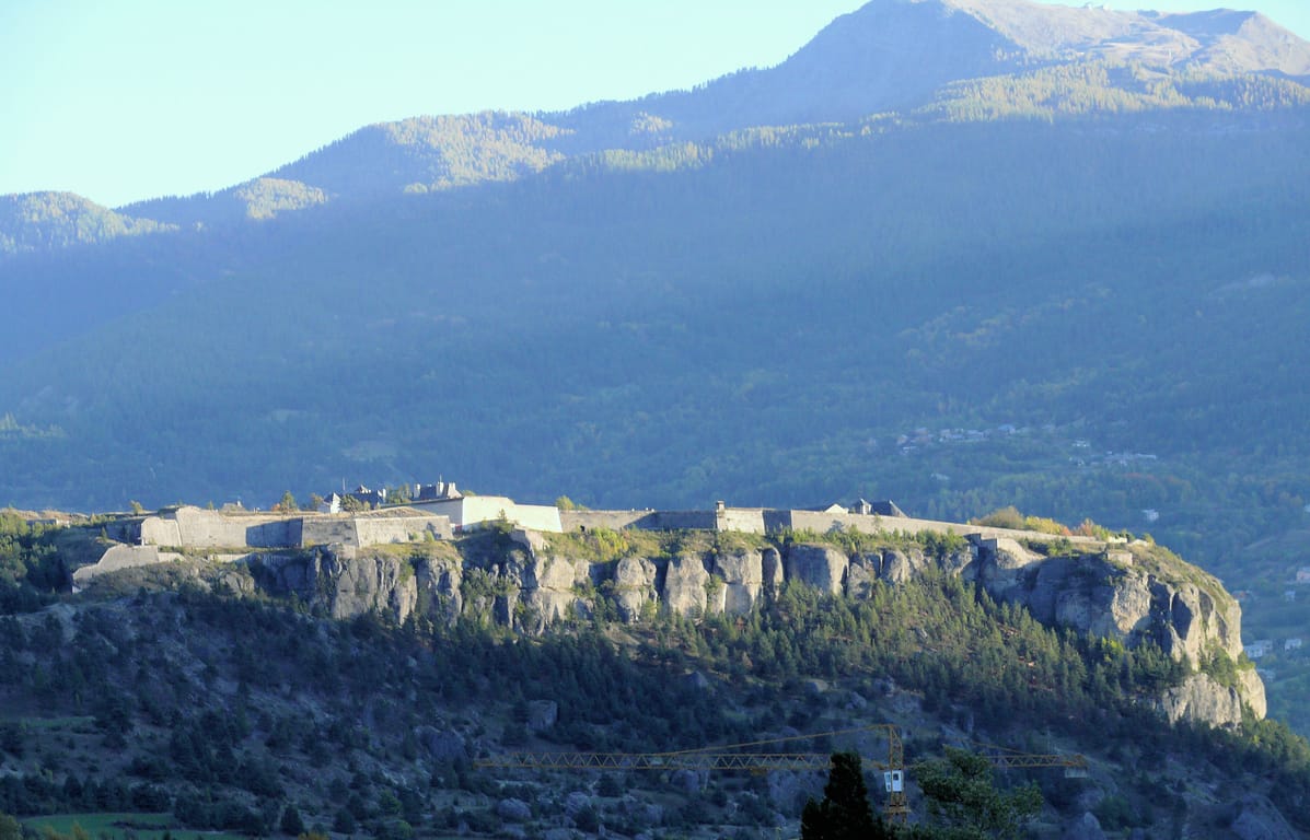
10 Village
Mont-Dauphin
Mont-Dauphin (05600) · 35 km · 48 min
AI contentDiscover Mont-Dauphin on a rocky plateau that watches over the meeting of the Durance and the Guil, at the crossroads of the routes to the Queyras and Briançon. The fort, designed by Vauban, is a World Heritage Site among the engineer's strongholds. All around, erosion has carved the conglomerate into pinnacles, including the one nicknamed the Titan's Hand.
The night — Booking, Park4night or Airbnb
Day 6 Briançon → Arvieux 2 stops · 56 km · ≈ 1h19
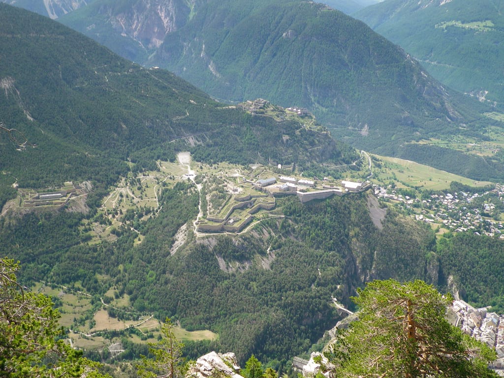
11 Castle
Fort des Têtes
Briançon (05100) · 37 km · 55 min
AI contentBuilt from 1721 to 1734 on the plateau overlooking Briançon, Fort des Têtes follows the plans of Vauban, who saw this plateau as a threat to the town. Spot its silhouette from the old town, beyond the Pont d'Asfeld over the Durance. Listed by UNESCO in 2008, this triangle of three bastions housed 1,200 soldiers.
12 Mountain
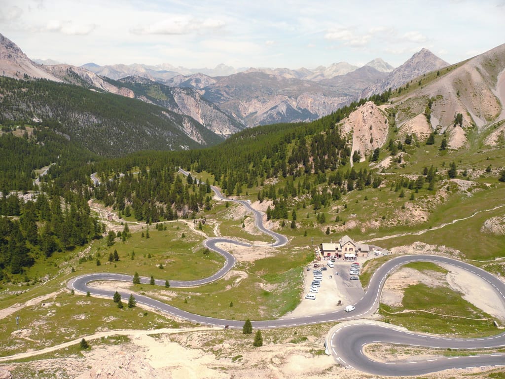
Col d'Izoard
Arvieux (05350) · 19 km · 24 min
AI contentBuilt by General Berge between 1893 and 1897, the road crosses the pass at 2,362 metres, between Briançon and Château-Ville-Vieille. On the southern side, drive through the Casse Déserte, where needles of cargneule rise from bare scree. On the way out, a stele honours Bobet and Coppi, as the Tour de France often takes this pass.
The night — Booking, Park4night or Airbnb